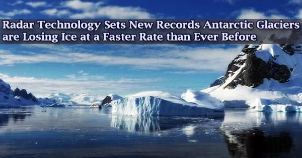
With a surface area of 14,000,000 km2, Antarctica is the world’s largest ice sheet. Much of the surface of the Antarctic ice sheet is higher than 3000 meters above sea level. The vast layer of ice submerges entire mountain ranges, and there are countless volcanoes beneath the icey surface.
Three glaciers at the South Pole are being studied with degrees of clarity and completeness never seen before in a new University of Houston study employing an innovative remote imaging method known as synthetic aperture radar interferometry.
The new remote sensing data system is not only revealing cold secrets from Earth’s least studied continent, but it is also raising concerns about current and future global climate threats.
A report published in Nature Geosciences details the rapid and unexpected retreat of the Pope, Smith, and Kohler glaciers in West Antarctica’s Amundsen Sea Embayment.
“Thanks to the new generation of radar satellite, we have been able in recent years to witness retreat rates faster than ever observed among glaciers around the world. That’s a warning sign that things are not settling, not stabilizing at all. This could have severe implications for the equilibrium of the entire glacier system in this area,” said radar scientist Pietro Milillo, assistant professor of civil engineering at UH and the article’s lead author.
Milillo is joined by the University of California Irvine researchers and scientists from three national space agencies in this ongoing worldwide investigation of data obtained by the TanDEM-X and COSMO-SkyMed satellites: NASA, the German Aerospace Center (DLR), and the Italian Space Agency (ASI).
The quantity of the world’s ice reservoirs and the ice thickness distribution, both of which are unknown, dictate the impact of climate change on water resources and sea-level rise.
Thanks to the new generation of radar satellite, we have been able in recent years to witness retreat rates faster than ever observed among glaciers around the world. That’s a warning sign that things are not settling, not stabilizing at all. This could have severe implications for the equilibrium of the entire glacier system in this area.
Pietro Milillo
Antarctica is the world’s fifth largest continent and the world’s highest and coldest continent on average. Through the geomorphological record of glacier moraines, ice cores, deep sea sediment cores, and previous records of sea level rise, it gives a unique record of the Earth’s past climate.
The research team intends to apply what they’ve learned about the Pope, Smith, and Kohler glaciers to their larger and more vulnerable West Antarctica neighbors, the Thwaites and Pine Island glaciers, as well as the entire Antarctic glacier system.
“The issue here is that we found such a high retreat rate so high that we actually see these three smaller glaciers could actually capture the basin from the nearby Thwaites glacier, which would cause Thwaites to lose more mass,” Milillo said.
“In Antarctica, glaciers don’t melt because of interaction with the sun. They melt because they accelerate and inject more ice into the ocean. That is one of the principal mechanisms of mass loss.”
The South Pole, at the farthest point on the planet, is dark for the majority of the year. Due of the harsh weather, researchers may only visit for brief periods of time, which limits their research. (As Milillo points out, Antarctica is so far away that the closest humans are usually astronauts aboard the International Space Station orbiting the earth.)
“Radar is perfect for those applications. The beauty of radar is that it can penetrate clouds. It can look in any weather condition. It is also an active sensor, so we don’t have to rely on the light of the sun,” he said.
“In the past, we needed to wait several years in order to accumulate enough useful data. For that reason, we could observe only long-term trends. Now we can look at retreats on a monthly basis and can capture a new level of detail that will help improve glacier models and, in turn, refine our sea level rise estimates,” Milillo said.
The team examines bi-weekly elevation changes to determine retreat at a glacier’s grounding line, the border on the underside of a glacier where frozen land meets warmer water, as part of the monthly measurements. Because the warm water carves out an ice shelf that begins to float and may easily break away, the grounding line becomes more susceptible.
“If all ice above floatation in Antarctica would melt, the sea level would go up on average by 58 meters (190 feet),” Milillo said. “If the signals we are looking at are confirmed, the mass loss from Antarctica, as well as Greenland, will rise. As they rise, the sea level will increase.”
“If all these glaciers melt, the sea water could raise rapidly. With 267 million people worldwide living on land less than 2 meters (6.6 feet) above sea level, an abrupt migration could result. Also, subsidence could eventually see large structures sinking in vulnerable locales, including Houston,” Milillo said. “That’s why people should care about this issue. Even if doesn’t affect their life, it will affect their kid’s life and their grandkid’s life.”
For the time being, Milillo is focused on the near future, especially NASA’s plans to deploy its NISAR satellite in 2023, which will offer even more data and more frequently than the current state-of-the-art synthetic aperture radar.
The satellite, also known as NASA-ISRO SAR, will track changes in ecosystems, dynamic surfaces, and ice masses, giving Milillo and his colleagues a clearer image of our changing planet.