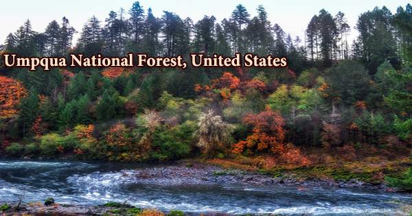
The Umpqua National Forest is located at the crossroads of many geologic provinces, offering a diverse range of habitats for a variety of plants and animals. The forest in southern Oregon’s Cascade Range spans 983,129 acres (3,978.58 km2) and surrounds Crater Lake National Park in Douglas, Lane, and Jackson counties. The term Umpqua roughly translates to “Thundering waters” or “across the waters,” but another Umpqua language word that has survived is “satisfied,” which refers to a full stomach. Cottage Grove, Diamond Lake, North Umpqua, and Tiller ranger districts make up the forest’s four ranger districts. The United States Forest Service, based in Roseburg, is in charge of the forest.
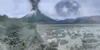
The distinctive landscape on the 984,602-acre Umpqua National Forest has been influenced by explosive geologic events, notably the eruption of Mt. Mazama, which created Crater Lake nearly 7,000 years ago. The geologic past of the area has resulted in breathtaking scenery as well as a wealth of natural and cultural resources. Thundering waters, high mountain lakes, heart-stopping rapids, and calm ponds are all part of the experience for visitors. Before Mt. Mazama erupted and formed Crater Lake 7,000 years ago, the Umpqua, Southern Molalla, Yoncalla, and Cow Creek Band of Umpqua Tribe of Indians lived in the forest. As European settlers began to encroach, Native Americans were relocated to reservations in 1856, further fragmenting the tribes.
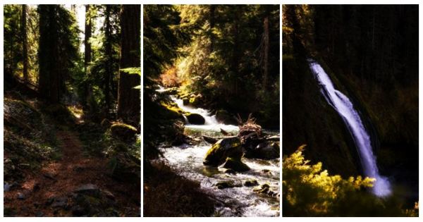
Lower-elevation forests of mixed conifers and hardwoods transition from stands of western hemlock, true fir, Douglas-fir, and cedar. The Forest is known for its abundance of waterfalls, including the 272-foot Watson Falls on the North Umpqua Highway. The Boulder Creek Wilderness, which covers 19,100 acres, is fully contained within the Forest. Mount Thielsen, at 9,182 foot (2,799 meters), and Mount Bailey, at 8,363 foot (2,549 meters), are separated by timbered valleys of old-growth ponderosa and oak groves. Monolithic spires of volcanic basalt and andesite with descriptive names including Eagle Rock, Rattlesnake Rock, and Old Man are notable geologic features.
This enjoyable hike through the Umpqua National Forest is suitable for hikers of all abilities. The path is well-marked, and signs guide you to one of Umpqua’s most spectacular waterfalls. On July 2, 1907, the United States Congress established the Umpqua National Forest. The Umpqua National Forest brings together many distinct geologic provinces, offering a diverse range of habitat for a wide variety of plants and wildlife. Winter steelhead, Chinook and coho salmon, sea-run cutthroat trout, and Pacific lamprey are among the 18 fish species found in the forest.
In the 1930s, the Civilian Conservation Corps worked in the Umpqua National Forest, constructing highways, bridges, and recreation facilities. In 1940, the highway linking Roseburg and Diamond Lake (Hwy. 138) was completed, resulting in an increase in logging in the Forest’s upper reaches. There are 66 mammal species, 236 bird species, and 27 reptile and amphibian species in the forest. Anadromous, or sea-going fish, have access to 359 miles of lakes, with thousands more stretching through the forest landscape. According to a 1993 Forest Service survey, the forest’s old growth covered 535,300 acres (216,600 ha), with mountain hemlock (Tsuga mertensiana) forests accounting for 82,200 acres (33,300 ha).
The Umpqua National Forest is located at the crossroads of many geologic provinces, offering a diverse range of habitat for a variety of plants and animals. There are 54 established campgrounds with nearly 800 campsites in the Forest, as well as six historic cabins and lookouts for sale. There are 66 mammal species, 236 bird species, and 27 reptile and amphibian species found in the forest. There are 359 miles of anadromous fish-bearing streams in the Forest, and thousands more miles.
Camping, fishing, hiking, horseback riding, mountain biking, rock climbing, and boating are all common activities in the forest. Nordic and downhill skiing, as well as snowshoeing and snowmobiling, are all common winter activities. There are three separate Wilderness Areas in the Umpqua National Forest. Small waterfalls and rapids link the series of quiet pools that make up Boulder Creek, a tributary of the North Umpqua River and the namesake for the Boulder Creek Wilderness, a low-lying and small wilderness that is accessible by trail all year.
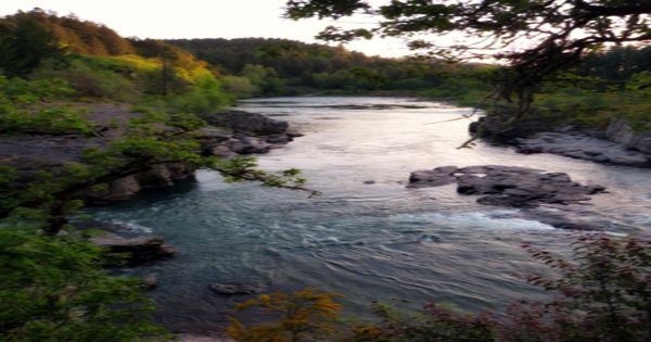
For those looking to spend the night in the Umpqua National Forest, the Twin Lakes Trail is a wonderful choice. Before you finish the trail, have a nice picnic, go fishing, and enjoy the easy campsites. A section of the North Umpqua River was designated as Wild and Scenic by the Oregon Omnibus Wild and Scenic Rivers Act in 1988. The river runs through the forest for 26 miles. The Umpqua National Forest currently has 54 established campgrounds with nearly 800 campsites, five historic cabins and lookouts for hire, 350 miles of year-round trail, 1,150 miles of car travel paths, and four staffed lookouts.
Diamond Lake is the ideal location for year-round outdoor fun if you’re looking for a more enjoyable getaway. Take a boat or kayak out on the water and take in the breathtaking views of Mt. Thielsen. Boulder Creek, Rogue-Umpqua Divide, and Mount Thielsen are three wilderness areas in the Umpqua National Forest.
Boulder Creek is a North Umpqua River tributary and the source of the Boulder Creek Wilderness. It’s a 19,100-acre (77-square-kilometer) wilderness area 50 miles (80 kilometers) east of Roseburg. Pine Bench is a common area in Boulder Creek. Pine Bench is a flat field with a grove of magnificent old growth ponderosa pines that overlooks Boulder Creek. The Spring Fire in the Boulder Creek Wilderness burned 16,500 acres (67 km2) in 1996.
The Rogue-Umpqua Divide is a 33,000-acre (130-square-kilometer) wilderness area, with 26,350 acres (106.6 square kilometers) within the National Forest. (About 17% of it lies within Rogue River–Siskiyou National Forest.) The Rogue-Umpqua Divide, located 80 miles (130 kilometers) east of Roseburg, divides the Rogue and Umpqua river drainages at an elevation of 3,200 to 6,878 feet (2,096 meters). Sub-alpine meadows and old-growth forests can be found in the wilderness.
Glaciers carved the 26,593-acre Mount Thielsen Wilderness, which includes the 9,182-foot tall Mount Thielsen. Because of the frequent lightning strikes, the pointy jagged summit is known as the “Lightning Rod of the Cascades.” Fulgurites, a glassy rock, have formed on the top 10 feet of the peak as a result of these events. This wilderness area, located 80 miles (130 kilometers) east of Roseburg, is the largest in the Umpqua. Mt. Thielsen, at 9,182 feet (2,799 meters), arose from the same volcanic activity that gave birth to Crater Lake, and several trails pass through deep pumice deposited when Mt. Mazama erupted. The Pacific Crest Trail runs right through the heart of the forest.
Diamond Lake is located at the base of Mt. Bailey and offers hiking, fishing, and ice fishing in the winter. On the North Umpqua Highway, the Forest has many huge and spectacular waterfalls, including the 272-foot Watson Falls and the 113-foot Toketee Falls. The North Umpqua Wild and Scenic River passes through the forest and offers a variety of fishing and boating opportunities. The reservoir that makes up Lemolo Lake is controlled by the North Umpqua Hydroelectric Dam. Swimming, boating, fishing, kayaking, canoeing, and even water skiing are all available at this lake, which is surrounded by Mount Thielsen in the distance. The nearby Lemolo Falls Trail is a short distance away, and the lake has both a campsite and a beach.
Information Sources: