Researchers at the University of Texas Institute for Geophysics (UTIG) have created a radar method that enables them to photograph features that are concealed in the top few feet of ice sheets. The technique’s developers claimed that it might be used to look inside Earth’s melting glaciers as well as find possibly habitable regions on Jupiter’s moon Europa.
With airborne or satellite ice-penetrating radar, it is challenging to investigate the near-surface layers of ice sheets because a large portion of what is scientifically significant occurs too closely to the surface to be adequately recorded. Because of this, scientists must rely on ground-based devices that provide only a small amount of coverage or perform the challenging and time-consuming task of excavating ice cores, which is currently not viable on other planets.
In order to increase resolution, the novel radar approach combines two separate radar bandwidths and searches for differences. Since the equipment are mounted on aircraft or satellites, researchers can quickly scan huge ice sheets.
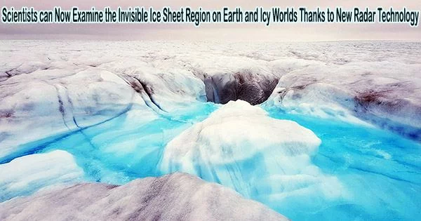
The scientists used radar surveys over the Devon Ice Cap in the Canadian Arctic to test the novel method and image an impenetrable slab-like layer of ice close to the surface. Further analysis suggested that the ice layer is redirecting surface melt from the ice cap’s snow-packed surface into water channels downhill. The research was published May, 2023, in the journal The Cryosphere.
We used an airborne radar to find ice slabs on Devon Ice Cap, but the same thing applies for detecting layers with an orbiting radar at ice-covered ‘ocean’ worlds like Jupiter’s moon Europa.
Kristian Chan
According to Kristian Chan, a graduate student at the UT Jackson School of Geosciences who devised the technique, the study’s findings about the ice slab layer could help scientists predict the future of the ice cap and its contribution to sea level rise.
“If you have only relatively thin ice layers then the firn (snow-packed surface layers) has the ability to absorb and retain surface meltwater,” Chan said. “But if these impermeable slabs are widespread then the contribution of surface melt to sea level rise is enhanced.”
Surface melt is normal on ice sheets during summer months. Meltwater seeps into and refreezes deeper in the snow as it warms up on top from the previous winter, creating thin ice layers.
However, the majority of the ice layers on the Devon Ice Cap are far thicker than anticipated, with some creating slabs up to 16 feet thick over a distance of several kilometers. They are therefore particularly efficient in diverting meltwater, as the researchers discovered when they compared the locations of meltwater rivers with those of the thickest ice slabs.
Chan said the findings demonstrate what scientists can accomplish with the new technique.
“We used an airborne radar to find ice slabs on Devon Ice Cap, but the same thing applies for detecting layers with an orbiting radar at ice-covered ‘ocean’ worlds like Jupiter’s moon Europa,” he said.
Chan is part of a UTIG group, led by Senior Research Scientist Don Blankenship, that is developing a radar instrument called REASON, which will launch aboard NASA’s Europa Clipper in 2024.
The investigation of Jupiter’s moons Europa and Ganymede will soon be aided by two ice-penetrating radar equipment, along with a spacecraft from the European Space Agency that launched this year. Both radar systems are compatible with Chan’s technique.
The new method will enable researchers to look inside the first few feet of the icy shells, where they may discover frozen brine, cryovolcanic remains, or even plume fallout deposits. All are either potential habitats or clues about habitable environments in the subsurface, said coauthor Cyril Grima, a UTIG research associate who is also part of the REASON team.
“Kristian has given us the ability to see things in this hidden part just beneath the surface that is potentially accessible to future landers,” Grima said. “It’s really improved the reconnaissance ability of those radars.”
The NASA Texas Space Grant Consortium at UTIG, and the G. Unger Vetlesen Foundation supported the research. UTIG is a research unit of the UT Jackson School of Geosciences.