Michael Rawlins, a professor in the University of Massachusetts Amherst’s geosciences department and associate director of the Climate System Research Center, has made significant progress in filling out our understanding of the Arctic’s carbon cycle, or the way carbon is transferred between the land, ocean, and atmosphere, in a pair of recently published papers.
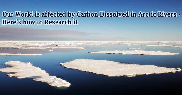
We need a more complete understanding of how carbon cycles through reservoirs in our environment to better comprehend future patterns in atmospheric carbon dioxide and the consequent global warming. In comparison to other seas, the Arctic Ocean receives a substantial volume of freshwater from river runoff. The Mackenzie and Yukon rivers in North America, and the Ob, Yenisey, and Lena Rivers in Asia, are the five primary rivers that flow into the Arctic.
“There’s been a lot of research that has looked at the vertical flow of carbon from land to the atmosphere,” says Rawlins. Burning fossil fuels, forest fires, leaking methane gas, and emissions from thawing permafrost are all part of this vertical flow. However, there is a horizontal component to the cycle. “Far less attention has been paid to how carbon is transferred from land to the ocean via rivers,” says Rawlins.
Water gathers up carbon as it rushes across the land, into streams and rivers, eventually bringing it all the way to the sea. A tiny but considerable amount of dissolved organic carbon (DOC) is “out-gassed” from river water and released as a greenhouse gas into the atmosphere. What’s left is washed into the sea, where it becomes an important component of coastal food webs.
Increased freshwater export has implications for salinity and other components of the lagoon aquatic environment.
Rawlins
Yet, especially in the Arctic, where observations are limited and fast warming is leading to intensification of the hydrological cycle, increased runoff, and permafrost melt, we know comparatively little about this ocean-ward, lateral carbon fluxes.
Rawlins’ two publications, which were published in the Journal of Geophysical Research and Environmental Research Letters, address this issue.
Rawlins and his co-authors included an accounting of the generation, breakdown, storage, and “loading” of DOC to streams and rivers to a numerical model that properly represents the seasonal accumulation of snow, as well as the freezing and thawing of soils. With remarkable precision, the model now mimics the quantity of carbon pouring off into the region’s waterways.
It’s the first model to account for seasonal variations in the quantity of DOC exported to the ocean, a distinct east-west gradient across 24 drainage basins on Alaska’s North Slope, and almost equal amounts of DOC flowing through the north- and west-draining rivers.
The model also indicates that the amount of freshwater and DOC transferred to a coastal lagoon in Northwest Alaska is increasing. The year 2019 stands noteworthy, with a significant freshwater DOC export approximately three times more than the quantity exported in the early 1980s.
“Increased freshwater export has implications for salinity and other components of the lagoon aquatic environment,” says Rawlins. The changes are linked to increasing precipitation, particularly during the summer, and the effects of warming and thawing soils.
“The largest freshwater and DOC increases,” says Rawlins, “occur in Autumn, which is not surprising given the significant losses in sea ice across the nearby Beaufort and Chukchi Seas, in turn connected to our warming climate.”
Finally, this new model will aid scientists in refining carbon baselines and better understanding how global warming affects the carbon cycle on Earth.
This research was supported by the US Department of Energy, National Aeronautics and Space Administration, and the National Science Foundation, and is affiliated with DOE’s Next-Generation Ecosystem Experiments-Arctic project (NGEE-Arctic), NASA’s Arctic Boreal Vulnerability Experiment (ABoVE) and the NSF-supported Beaufort Lagoons Ecosystems Long-Term Ecological Research project (BLE-LTER).
