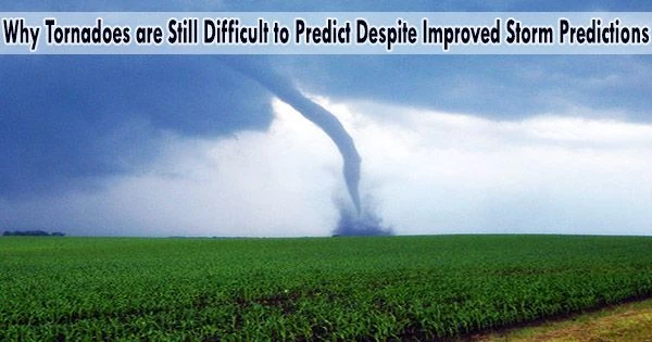
On March 24, 2023, forecasters detected a devastating tornado forming on radar and sent out a rare “tornado emergency” warning as it approached Rolling Fork, Mississippi. Since many days ago, NOAA’s Weather Prediction and Storm Prediction centers have been issuing alerts about the potential for severe weather in the area.
Although forecasters are able to spot the warning signals of prospective tornadoes in advance, it is still very challenging to predict when and where tornadoes will emerge.
We asked Chris Nowotarski, an atmospheric scientist who works on severe thunderstorm computer modeling, to explain why and how forecast technology is improving.
Why are tornadoes still so difficult to forecast?
Forecasting the weather conditions that increase the likelihood of tornadoes has greatly improved. However, pinpointing which thunderstorms will create a tornado and when is more difficult, and this is the area of severe weather research that receives the majority of attention today.
Often, you’ll have a line of thunderstorms in an environment that looks favorable for tornadoes, and one storm might produce a tornado but the others don’t.
It’s possible that little variations in meteorological factors like temperature are what separates them. If the land surface conditions alter, a tornado may arise in farms, forested areas, or urban settings. The processes inside storms that can make or break a tornado can be significantly affected by these modest changes in the storm environment.
Vertical wind shear, or how the wind changes direction or speed with height in the atmosphere, is one of the most reliable indicators of whether a thunderstorm may create a tornado.
How wind shear interacts with rain-cooled air within storms, which we call “outflow,” and how much precipitation evaporates can influence whether a tornado forms. If you’ve ever been in a thunderstorm, you know that right before it starts to rain, you often get a gust of cold air surging out from the storm. Because tornadoes often occur in that cooler part of the storm, the features of that cold air outflow are crucial to determining if a tornado can form.
How far in advance can you know if a tornado is likely to be large and powerful?
It’s complicated. Radar is still our biggest tool for determining when to issue a tornado warning meaning a tornado is imminent in the area and people should seek shelter.
Supercell thunderstorms, which have a powerful rotating updraft known as a “mesocyclone,” are the primary source of the great majority of strong tornadoes. The midlevels of the storm may rotate due to vertical wind shear, and the mesocyclone’s upward suction may increase the rotation of the storm’s outflow into a tornado.
Supercells that rotate vigorously above the earth are frequently precursors to tornadoes. According to some studies, wider mesocyclones are more likely than other storms to produce stronger, longer-lasting tornadoes.
Forecasters also look at the storm’s environmental conditions temperature, humidity and wind shear. Those offer more clues that a storm is likely to produce a significant tornado.
The percentage of tornadoes that receive a warning has increased over recent decades, due to Doppler radar, improved modeling and better understanding of the storm environment. About 87% of deadly tornadoes from 2003 to 2017 had an advance warning.
The lead time for warnings has also improved. In general, it’s about 10 to 15 minutes now. That’s enough time to get to your basement or, if you’re in a trailer park or outside, to find a safe facility. Not every storm will have that much lead time, so it’s important to get to shelter fast.
What are researchers discovering today about tornadoes that can help protect lives in the future?
If you think back to the movie “Twister,” in the early 1990s we were starting to do more field work on tornadoes. With trucks and cars equipped with roof-mounted equipment, we were deploying radar into storms. That’s when we really began to understand what we refer to as the storm-scale dynamics, or the conditions inside the storm itself and how changes in outflow temperature and humidity might affect the likelihood of tornadoes.
Scientists can’t launch a weather balloon or send instruments into every storm, though. So, we also use computers to model storms to understand what’s happening inside. Often, we’ll run several models, referred to as ensembles. For instance, if nine out of 10 models produce a tornado, we know there’s a good chance the storm will produce tornadoes.
The National Severe Storms Laboratory has recently been experimenting with tornado warnings based on these models, called Warn-on-Forecast, to increase the lead time for tornado warnings.
There are a lot of other areas of research. For example, to better understand how storms form, I do a lot of idealized computer modeling. For that, I use a model with a simplified storm environment and make small changes to the environment to see how that changes the physics within the storm itself.
There are also new tools in storm chasing. Scientists are equipping drones with sensors and using them to fly them near and occasionally into storms as the use of drones have skyrocketed.
The focus of tornado research has also shifted from the Great Plains the traditional “tornado alley” to the Southeast.
What’s different about tornadoes in the Southeast?
Compared to the Great Plains, the Southeast has some different influences on storms. The Southeast has more trees, a more diversified topography, and greater atmospheric moisture due to its proximity to the Gulf of Mexico. Because more tornadoes originate at night in the Southeast, there are also more fatalities on average.
We tend to see more tornadoes in the Southeast that are in lines of thunderstorms called “quasi-linear convective systems.” The processes that lead to tornadoes in these storms can be different, and scientists are learning more about that.
Several studies have also hypothesized that tornadoes may be beginning to move climatologically toward the Southeast. However, it might be challenging to separate an increase in storms from improved technologies detecting more tornadoes. So, more research is needed.