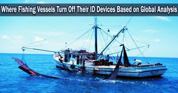
Data about international fishing activity, including illicit, unreported, and unregulated fishing, can be found in the shipboard Automatic Identification System (AIS), which was developed as a collision avoidance tool.
AIS equipment aboard fishing boats may be disabled, however a recent examination of purposeful disabling incidents in commercial fisheries reveals that while some disabling incidents might be justified, others seem to be cover-ups for unlawful activity.
In the current study, which was released on November 2 in Science Advances, the first global dataset on AIS disabling in commercial fisheries which hides up to 6% of vessel activity is presented.
Researchers from Global Fishing Watch, which manages an AIS record of vessel activity, and NOAA Fisheries collaborated on the study alongside Heather Welch, a project scientist in the Institute of Marine Sciences at UC Santa Cruz.
Welch utilized a machine learning technique to identify four main causes for AIS disabling after Global Fishing Watch created a means to separate intentional disabling from gaps in satellite coverage and other technical concerns.
“There are some legitimate reasons why vessels disabled their AIS, but we found two situations in which it is done for potentially nefarious reasons, either to fish in unauthorized locations or to obscure unauthorized transshipments,” she said. “This dataset is now operationalized, and the data are produced in real time, so it can be used to target inspections and improve fisheries management.”
For the analysis, the researchers found approximately 5 million hours’ worth of fishing vessel activity hidden by over 55,000 suspected purposeful disabling incidents between 2017 and 2019.
We might not always be able to see what vessels are doing, but knowing when they’re intentionally hiding their movements provides valuable information that managers and scientists didn’t have before. Having a better understanding of where vessels may hide their position allows authorities to deploy valuable on-the-water resources more strategically, supporting improved fisheries management.
Tyler Clavelle
Four hotspots accounted for more than 40% of the total hours that were allegedly masked by AIS disabling, three of which are regions where illegal fishing is a problem: the Northwest Pacific, the vicinity of Argentina’s Exclusive Economic Zones (EEZs), and countries in West Africa. These areas contain rich fishing grounds with limited management oversight.
“AIS data can tell us a lot, but so can the lack of it,” said coauthor Tyler Clavelle, a data scientist at Global Fishing Watch. “We might not always be able to see what vessels are doing, but knowing when they’re intentionally hiding their movements provides valuable information that managers and scientists didn’t have before. Having a better understanding of where vessels may hide their position allows authorities to deploy valuable on-the-water resources more strategically, supporting improved fisheries management.”
The concentration of AIS-disabling occurrences in the vicinity of EEZ boundaries raises the possibility that boats are turning off AIS before entering restricted areas to engage in illicit fishing. In many cases, vessels go dark as they approach the edge of an EEZ where they are not authorized to fish, Welch said.
“For example, you might see a Korean-flagged vessel heading toward Argentina, and then it goes dark in international waters just outside of Argentina’s EEZ,” she said.
Notably, disabling was more frequent near and within EEZs with overlapping claims, such as the Falkland/Malvinas Islands, which are contested by Argentina and the United Kingdom. The political conflicts in these regions may create blind spots for enforcement.
In regions with a lot of transshipment activity, as boats transfer their catches to frigid cargo ships, disabling occurrences were also frequent. Transshipment can be a rapid and effective way to transport the catch back to shore so you can get back to fishing, but it can also be used to cover up illegal fishing by “laundering” the harvest through the cargo ship. Additionally, it may permit forced labor on fishing vessels that never dock.
The study also discovered proof that some disabling is carried out by vessels taking part in legal activities for justifiable reasons. In some cases, Welch said, AIS disabling may be done to hide the locations of good fishing grounds from competitors. The fourth disabling hotspot was caused by U.S. trawlers disabling in U.S. waters off the coast of Alaska.
“This is one of the most intensely managed fishing grounds in the world, and these events likely constitute location hiding from competitors,” she said.
The other legitimate reason for disabling AIS is for protection from piracy. “Using a database of historical attacks, we can see that vessels switch off AIS in these historically dangerous waters, and that may be so that pirates aren’t able to track and intercept them,” Welch said.
The strategy presented in this study could be used to assist law enforcement and surveillance operations.
“This new dataset is an untapped resource that provides a real opportunity to detect previously unobserved behaviors and illegal fishing activities,” Welch said. “Authorities could use this information to decide where to send surveillance drones or patrol vessels, and it could also be used to focus port inspections on vessels that have disabled AIS adjacent to EEZ boundaries or in transshipment hotspots.”
In addition to Welch and Clavelle, the coauthors of the paper include Timothy White, Jennifer Van Osdel, Timothy Hochberg, and David Kroodsma at Global Fishing Watch; Megan Cimino, an assistant researcher at the Institute of Marine Sciences and assistant adjunct professor of ocean sciences at UCSC; and Elliott Hazen, assistant adjunct professor of ecology and evolutionary biology at UCSC.
Welch, Cimino, and Hazen are also affiliated with the NOAA Southwest Fisheries Science Center. The UCSC/NOAA Fisheries Collaborative Program supports collaborations between UCSC and NOAA Fisheries. This work was funded by the Catena Foundation and NOAA’s Office of Law Enforcement.