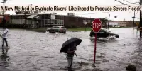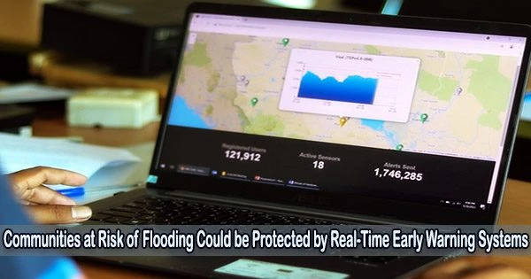
A recent study shows that including local communities in the creation of a real-time early warning system could help to lessen the frequently disastrous effects of flooding on people and property, especially in mountainous areas where high water occurrences are a “wicked” problem.
Although experts believe that employing a SMART strategy to connect with persons residing in such regions may assist to better warn approaching risk from flooding, flash floods are growing more frequent and dangerous to the lives and property of vulnerable people.
In order to enable catastrophe risk managers, hydrologists, and engineers better create techniques to raise the alarm before to severe floods, scientists believe that merging meteorological data with information on how people live and work in such places will be beneficial.
An international research team led by the University of Birmingham believes that combining science, policy, and locally community-led approaches will help to produce environmental decisions that are better tailored to the local context and has published their findings in the journal Natural Hazards and Earth System Sciences.
Developing community trust in government agencies and tech-focused forecasting, whilst using community-led means of gathering information in data-scarce mountainous regions is critical in protecting vulnerable people. Using this SMART approach to engage communities in developing inclusive and purposeful early warning systems will undoubtedly help to develop capacity, adaptation, and resilience in the face of more extreme water extremes, such as floods and droughts, and increased uncertainty under global change.
Professor David Hannah
Co-author Tahmina Yasmin, Postdoctoral Research Fellow at the University of Birmingham, commented, “A ‘wicked’ problem is a social or cultural challenge that’s difficult or impossible to solve because of its complex, interconnected nature. We believe that integrating social science and meteorological data will help to identify unknown parts of the puzzle when designing an early warning system.”
“Better engaging with communities and analyzing social factors identified by the community at risk for example, illegal settlement beside riverbanks or slums will help those driving policy to better understand the risks posed by these hydrometeorological extremes and plan flood response and mitigation which provides communities with improved protection.”
The researchers say that using a SMART approach helps policy makers to expose communities’ vulnerability and risk, by using a set of fundamental principles:
- S = Shared understanding of risks ensuring every group of people in a community is represented and a wide range of data collection methods are used.
- M = Monitoring risks and establishing warning systems that build trust and exchange critical risk information helping to maintain the forecasting system.
- A = Building Awareness through training and capacity development activities which embed understanding of real-time weather and flood alert information.
- RT = Indicating pre-planning Response actions on Time with comprehensive disaster management and evacuation plans based on the alert produced by the EWS.
Co-author David Hannah, Professor of Hydrology and UNESCO Chair in Water Sciences at the University of Birmingham, commented, “Developing community trust in government agencies and tech-focused forecasting, whilst using community-led means of gathering information in data-scarce mountainous regions is critical in protecting vulnerable people.”
“Using this SMART approach to engage communities in developing inclusive and purposeful early warning systems will undoubtedly help to develop capacity, adaptation, and resilience in the face of more extreme water extremes, such as floods and droughts, and increased uncertainty under global change.”