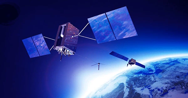
Researchers have created an algorithm that can “eavesdrop” on any satellite signal and use it to find any spot on Earth, similar to GPS. This is the first time an algorithm has been able to exploit signals transmitted by multi-constellation low Earth orbit satellite (LEO) satellites, including Starlink, OneWeb, Orbcomm, and Iridium.
Researchers discovered that by listening to the signals of eight LEO satellites for around 10 minutes, their system was able to locate a stationary receiver on the ground with exceptional accuracy and converge on it with an inaccuracy of only about 5.8 meters.
The study was presented last week at the IEEE/ION Position Location and Navigation Symposium (PLANS) 2023 conference in Monterey, California, by Zak Kassas, a professor of electrical and computer engineering at The Ohio State University and director of the Department of Transportation Center for Automated Vehicles Research with Multimodal AssurEd Navigation (CARMEN). The study, co-authored by Ohio State students Sharbel Kozhaya and Haitham Kanj, earned the conference’s Best Student Study award for demonstrating the first-ever exploitation of unknown OneWeb LEO satellite signals.
The researchers did not require assistance from the satellite operators to use the signals, and they stressed that they had no access to the actual data being transmitted by the satellites, only publicly available information about the satellites’ downlink transmission frequency and a rough estimate of the satellites’ location.
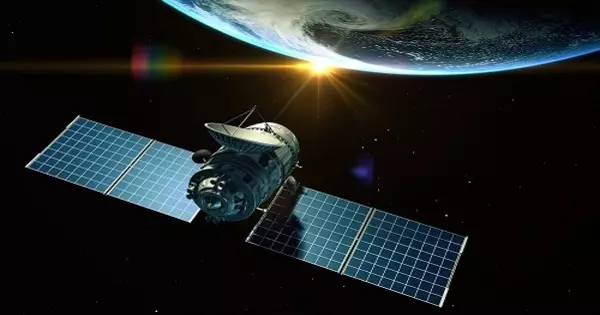
Almost every part of modern life relies on positioning, navigation, and timing data from global navigation satellite systems (GNSS), or GPS, that circle the Earth, from transportation to communication systems to the electrical grid and emergency services. Despite this, because GPS system signals are weak and vulnerable to interference, they can become unreliable in some circumstances, such as indoors or in deep urban canyons.
Furthermore, GNSS signals can be spoofed, posing major security threats in safety-critical applications such as aviation.
Such complexities, according to Kassas, could lead to a lot of navigational and cybersecurity issues in the long run, especially since practically all of our existing technologies rely largely on GPS. He emphasized that emerging technologies, such as driverless vehicles, are beginning to amplify the limits of our current GNSS systems.
“It’s becoming more urgent to find civilian and military alternatives to GPS, whether as a backup or in the event that GPS is completely unavailable,” Kassas said.
This research relies on prior work by Kassas’ lab, which used only six SpaceX satellite signals to locate a location with an accuracy of 10 meters, which was recently decreased to 6.5 meters.
“The Starlink study only scratched the surface of what is possible,” Kassas explained.
His research suggests using signals from LEO satellites as an alternative for humans’ locating, navigation, and timing needs, as they are approximately 20 times closer to Earth than GNSS satellites, which are located in medium Earth orbit – a little more than 20,000 kilometers above the planet. Kassas believes the technology might bring in a new era of positioning, navigation, and timing.
“We are living in the midst of a space renaissance.” Over the next decade, tens of thousands of LEO satellites will be launched into space, resulting in what are known as mega-constellations,” he stated. “Signals transmitted by these satellites will revolutionize numerous technologies and benefit scientific inquiry in fields such as remote sensing.”
According to Kassas, what distinguishes this work from all past attempts at developing an alternative to GPS is that, unlike earlier studies, this algorithm does not reverse engineer the signal.
“Our algorithm is agnostic to the LEO constellation,” Kassas explained. “Our receiver can listen to virtually any satellite signal, train on the data it receives in real-time, and then decipher certain features of the signal in a way that allows us to reconstruct what they are transmitting into location data.” The algorithm was used to four different LEO satellite constellations to demonstrate the team’s novel approach: Starlink, OneWeb, Orbcomm, and Iridium. With almost no prior information about what was being transmitted, the program cracked all of these signals.
Furthermore, because their method is so complex, the researchers were able to predict where the satellites are in space. To use the satellite to position itself, we must first determine where the satellite is located.
“That’s a very challenging problem because LEO satellites don’t normally broadcast their location, and our publicly available estimates of where they are is off by a few kilometers,” said Kassas.
Researchers set a ground receiver’s initial position estimate to the roof of an engineering parking structure at the University of California, Irvine, a spot more than 2,000 miles away from its actual position: the roof of Ohio State’s Electroscience Laboratory (ESL) in Columbus, Ohio, during a stationary experiment to test how the signals worked as an accurate positioning system. The algorithm was only around 5 meters wrong when it used satellite constellations to guess where the receiver was in the country.
In another experiment, the researchers put the receiver on top of a moving vehicle to see how the algorithm would perform. First, they used current navigation technology, which includes a GPS receiver and an inertial navigation system (INS). They navigated for around 100 meters before turning off the GPS and driving for over a kilometer. They discovered that using today’s GPS-INS system, they were claimed to be 500 meters away from their true location, but with their method, they were just 4.4 meters away. “Our results showed that our system is getting close to what you can do with GPS today,” Kassas explained.
Although a patent has been filed on the algorithm, Kassas stated that the team intends to continue expanding all of the algorithm’s technological capabilities.
“GPS is a very mature system that we entrust with our lives,” he explained. “More research on the accuracy, integrity, and continuity of new types of signals will be required before we can trust them with our lives.”
Joe Saroufim, Samer Hayek, and Mohammad Neinavaie from Ohio State were also co-authors. The Office of Naval Research, the Air Force Office of Scientific Research, the Department of Transportation, and the National Science Foundation all contributed to the research.
