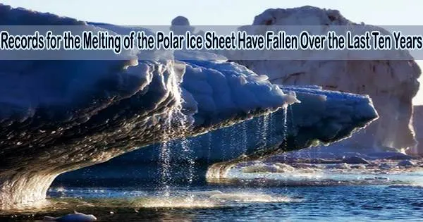
According to recent study, the previous ten years have seen the seven worst years for the melting and loss of polar ice, with 2019 being the worst year ever.
According to IMBIE, an international team of researchers who have aggregated 50 satellite surveys of Antarctica and Greenland made between 1992 and 2020, the melting ice sheets now account for a fifth of all sea level rise, a fivefold increase since the 1990s.
Their findings are published today in the journal Earth System Science Data.
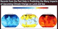
The polar ice sheets are melting due to global warming, raising sea levels and causing coastal floods all around the world. It is now possible to accurately assess the loss of ice from Greenland and Antarctica from space by monitoring changes in their volume, gravitational force, or ice movement.
NASA and the European Space Agency (ESA) and awarded funding to the Ice Sheet Mass Balance Intercomparison Exercise (IMBIE) in 2011 to compile the satellite record of polar ice sheet melting. Data collected by the team is widely used by leading organisations, including by the Intergovernmental Panel on Climate Change (IPCC).
In their latest assessment, the IMBIE Team, which is led by Northumbria University’s Centre for Polar Observations and Modelling, have combined 50 satellite surveys of Antarctica and Greenland to determine their rate of ice melting.
They discovered that between 1992 and 2020, the polar ice sheets on Earth lost 7,560 billion tonnes of ice, or the equivalent of an ice cube 20 kilometers high.
This is another milestone in the IMBIE initiative and represent an example of how scientists can coordinate efforts to assess the evolution of ice sheets from space offering unique and timely information on the magnitude and onset of changes. The new annual assessments represent a step forward in the way IMBIE will help to monitor these critical regions, where variations have reached a scale where abrupt changes can no longer be excluded.
Dr. Diego Fernandez
Every year since satellite records began, the polar ice sheets have collectively lost ice, and the last ten years have seen seven of the fastest melting rates.
According to satellite data, 2019 set a new record for ice sheet melting, losing a stunning 612 billion tonnes of ice.
This loss was caused by an Arctic summer heatwave that set a record for Greenland melting that year, which peaked at 444 billion tonnes. Due to the continuous acceleration of glaciers in West Antarctica and record melting from the Antarctic Peninsula, Antarctica shed 168 billion tonnes of ice in 2016, the sixth-highest amount ever recorded. The East Antarctic Ice Sheet remained close to a state of balance, as it has throughout the satellite era.
Melting of the polar ice sheets has caused a 21 mm rise in global sea level since 1992, almost two thirds (13.5 mm) of which has originated from Greenland and one third (7.4 mm) from Antarctica.
In the early 1990s, ice sheet melting accounted for only a small fraction (5.6 %) of sea level rise. However, since then, melting has increased fivefold, and they are now accountable for more than 25.6% of all sea level rise. By the end of the century, the ice sheets are expected to contribute between 148 and 272 mm to the rise in the ocean’s mean level if they keep losing mass at this rate.
Professor Andrew Shepherd, Head of the Department of Geography and Environmental Sciences at Northumbria University and founder of IMBIE, said: “After a decade of work we are finally at the stage where we can continuously update our assessments of ice sheet mass balance as there are enough satellites in space monitoring them, which means that people can make use of our findings immediately.”
Dr. Inès Otosaka from the University of Leeds, who led the study, said: “Ice losses from Greenland and Antarctica have rapidly increased over the satellite record and are now a major contributor to sea level rise. Continuously monitoring the ice sheets is critical to predict their future behaviour in a warming world and adapt for the associated risks that coastal communities around the world will face.”
Due to ongoing collaboration between the satellite agencies and the scientific community, this is the IMBIE team’s third assessment of ice loss. The first and second assessments were published in 2012 and 2018/19.
ESA and NASA have worked hard in recent years to put new satellite missions capable of observing the polar areas into orbit. These have been used by the IMBIE project to create more frequent updates, making it possible for the first time to record polar ice sheet losses on an annual basis.
This third assessment from the IMBIE Team, funded by the ESA and NASA, involved a team of 68 polar scientists from 41 international organisations using measurements from 17 satellite missions, including for the first time from the GRACE-FO gravity mission.
Importantly, it aligns the records of ice loss from Greenland and Antarctica using the same techniques and time frames. To ensure that the scientific community obtains the most recent estimates of polar ice losses, the assessment will now be updated annually.
Dr. Diego Fernandez, Head of Research and Development at ESA, said: “This is another milestone in the IMBIE initiative and represent an example of how scientists can coordinate efforts to assess the evolution of ice sheets from space offering unique and timely information on the magnitude and onset of changes.”
“The new annual assessments represent a step forward in the way IMBIE will help to monitor these critical regions, where variations have reached a scale where abrupt changes can no longer be excluded.”