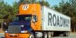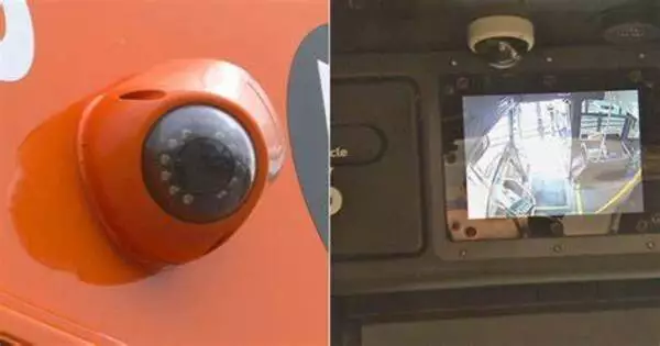
Using cameras on transit buses to monitor traffic conditions is a practical and cost-effective technique to acquire real-time traffic data. Researchers have developed a revolutionary way for counting and tracking automobiles on public roads, a development that could improve current traffic systems and help travelers get to their destinations faster.
Researchers at The Ohio State University demonstrated that they could automatically and reliably count vehicles on metropolitan streets, recognize items in the road, and distinguish parked vehicles from moving vehicles using cameras previously installed on campus buses.
Previous research by Ohio State University demonstrated that deploying mobile cameras provides considerably greater spatial and temporal coverage than depending on sparsely and frequently positioned sensors that don’t provide a view of many streets and highways in a metropolis.
Our goal is to start building a system that could do this without much manual intervention because if you want to collect this information over lots of potential vehicles and lots of time, it’s worth fully automating that process.
Tom Holman
“If we collect and process more comprehensive high-resolution spatial information about what’s happening on the roads, then planners could better understand changes in demand, effectively improving efficiency in the broader transportation system,” said Keith Redmill, lead author of the study and a research associate professor of electrical and computer engineering at Ohio State.
Previously, researchers utilized human observers to manually identify the automobiles in the films; now, new study, published in the journal Sensors, uses AI to automate the process.
According to co-authors of the study Mark McCord and Rabi Mishalani, both professors of civil, environmental, and geodetic engineering at Ohio State, their team chose to utilize the traffic cameras on the Campus Area Bus Service partly because Ohio State’s large, interconnected campus resembles a small city and their relationship with CABS operators gave them ready access to the collected videos.
“Sharing access to our bus cameras for traffic monitoring is a great example of how university operations can support research and learning,” says Tom Holman, director of Transportation and Traffic Management at Ohio State. “We are delighted to share existing resources that can generate useful data for long-term traffic planning on campus and elsewhere.”
But what distinguishes this study from comparable traffic-related studies is that it makes use of free resources: bus cameras that were already deployed for other safety and security purposes. According to Mishalani, this allows it to be readily integrated into how other cities organize traffic monitoring.
“If we can measure traffic in a way that is as good or better than what is conventionally done with fixed sensors, then we will have created something incredibly useful extremely cheaply,” he said. “Our goal is to start building a system that could do this without much manual intervention because if you want to collect this information over lots of potential vehicles and lots of time, it’s worth fully automating that process.”
The system works by utilizing a state-of-the-art 2D deep learning model called YOLOv4 to automatically detect and track objects. The program is also uniquely adept at recognizing multiple objects in a single image frame, said Redmill.
While the system is still a long way from being fully implemented, the study reveals that the system’s results hold promise for the future of intelligent traffic surveillance. For example, in addition to counting vehicles, their system can project real-world bird’s-eye-view coordinates of the road network by utilizing image streams, GNSS measurements, and regional information from 2D maps. The technology is so exact that it can identify if the bus deviates from its scheduled route and submit it to a map database that stores specific information about the roadways, according to Redmill, who is also a member of Ohio State’s Control and Intelligent Transportations Research Lab (CITR).
The huge collection and total automation of processing of this data over time would enable for more effective planning, designing, and operating of roadways to minimize excessive traffic across the country with widespread deployment and integration of their suggested approach. In terms of public advantages, such developments in traffic surveillance may result in shorter travel times and more travel options when attempting to get from point A to point B.