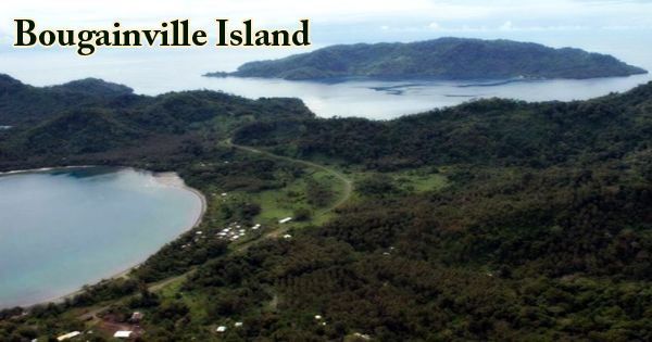
Bougainville Island (Tok Pisin: Bogenvil), Papua New Guinea’s easternmost island, in the Solomon Sea, in the Pacific Southwest. It formed the principal landmass of the North Solomons aligned with the German Empire; its land measures 9,300 km2 (3,600 sq mi). It forms the Bougainville autonomous region with Buka Island and other island groups. Geographically, the largest of the Solomon Islands is Bougainville. Bougainville is 75 miles (120 km) long and 65–95 km (40–60 miles) high. With its highest peaks at Balbi (9,000 feet (2,743 meters)) and Bagana, both active volcanoes, Emperor Range occupies the northern half of the island, and the southern half is occupied by the Crown Prince Range. Coral reefs border the shoreline. The province’s population is about 300,000 (2019 census), which includes islets such as the Carterets. The highest point is Mount Balbi, on the main island, at 2,715 m (8,907 ft).
(Bougainville Island)
In 1768, the French navigator Louis-Antoine de Bougainville, after whom both were named, visited the main island and the passage between it and Choiseul Island (southeast). Bougainville, placed under German administration in 1898, was occupied in 1914 by Australian forces and included in 1920 in an Australian mandate. It is the largest archipelago of the Solomon Islands, most of which, concentrated south and east, are politically autonomous as the Solomon Islands; two of these are less than 9 km (5.6 mi) north or northwest of Bougainville in the close-knit Shortland Islands; they are about 30 km (19 mi) west of Choiseul, a settlement facing Bougainville, Poroporo.
Japan occupied the island in 1942, during World War II, but the Bougainville effort to retake possession of the island was initiated by allied forces in 1943. The Japanese garrisons remained on the island until 1945, despite heavy bombardments. The Territory of New Guinea, including Bougainville, reverted to Australian rule following the war. After the war, as part of the UN (United Nation) Trust Territory of New Guinea, Bougainville was returned to the Australian government, and when Australia granted Papua New Guinea independence in 1975, the island became part of that new nation (country). Bougainville formed the North Solomons Province of Papua New Guinea with the Buka and the Kilinailau, Tauu, Nukumanu, Nuguria, and Nissan groups; it was renamed Bougainville Province in 1997.
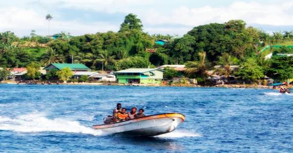
A peace agreement was signed in 2001 that included the guarantee of a referendum on Papua New Guinea’s independence. Between 23rd November and 7th December 2019, this referendum was held, with results being announced on 11th December. An option between greater autonomy within Papua New Guinea or complete independence was the referendum issue. 98.31 percent of the eligible voters were in favor of full independence. The vote is not binding; the final say on the status of Bougainville is made by the government of Papua New Guinea. Bougainville’s main cities include Arawa and Kieta, the latter supporting much of the area’s commercial enterprise. With a complex tropical climate, Bougainville Island is mainly forested.
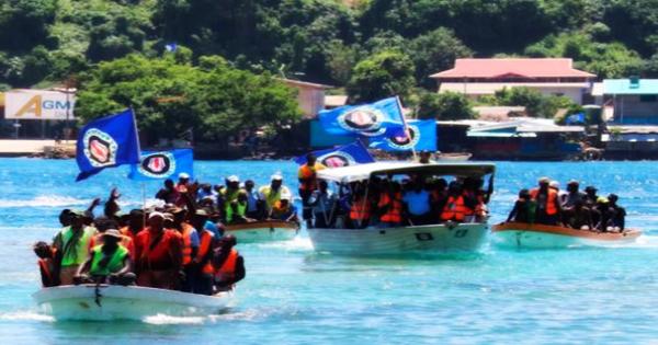
(Bougainville votes for independence from Papua New Guinea)
Copra is exported from Kieta, along with some cocoa and timber. Panguna’s copper deposits were the basis for one of the world’s largest open-pit mines; production started in 1972 and accounted for more than half of the total export earnings of Papua New Guinea by the early 1980s. Copper mining on the island by a Rio-Tinto-owned mining company caused major damage from the degradation of forest and heavy metal polluted mine tailings to the immediate and downstream ecology, resulting in an uprising by the islanders to protect their land and indigenous ecology. While the government of Bougainville voted to reopen the Panguna mine in 2005, the matter was not expected to be resolved for many years.
In Bougainville Province, there are several indigenous languages belonging to three families of languages. The languages of the northern end of the island belong to the Austronesian family, and others are scattered around the coast. The North and South Bougainville families belong to the languages of the north-central and southern lobes of Bougainville Island. More than 20% of the population speak none of the languages, and larger languages such as Nasioi, Korokoro Motuna, Telei, and Halia are divided into dialects that are not always mutually comprehensible. Cut off by a Papua New Guinean blockade during the Coconut Revolt from the outside world for many years, the islanders suffered several deaths from a lack of medical services.
Information sources: