As Grace Frontin-Rollet spotted a pair of small rocky islands from the bow of the RV Tangaroa, red hues flushed across the early morning skies over the Kingdom of Tonga. Though the scenery was beautiful, a tinge of sulfur in the air reminded the marine geologist of what she and a team of scientists had traveled for six days over rough waters to see.
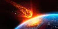
Using satellite images, researchers from the University of Oxford’s Department of Physics and RAL Space confirmed that the January 2022 eruption of the Hunga Tonga-Hunga Ha’apai volcano produced the highest-ever recorded plume. The massive eruption is also the first to have been directly observed to have broken through to the atmosphere’s mesosphere layer. The results have been published today in the journal Science.
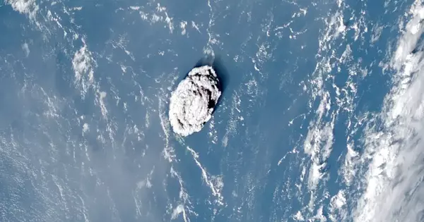
Hunga Tonga-Hunga Ha’apai, a submarine volcano in the Tongan archipelago in the southern Pacific Ocean, erupted violently on 15 January 2022. The explosion was one of the most powerful ever seen, sending shock waves around the world and triggering devastating tsunamis that left thousands homeless. A towering column of ash and water was ejected into the atmosphere, but scientists had no way of knowing how tall it was until now.
Normally, the height of a volcanic plume can be estimated by measuring the temperature recorded at the top by infrared-based satellites and comparing it to a reference vertical temperature profile. This is due to the fact that temperature decreases with height in the troposphere (the first and lowest layer of the Earth’s atmosphere). However, if the eruption is so large that the plume penetrates into the next layer of the atmosphere (the stratosphere), this method becomes ambiguous because the temperature begins to rise again with height (due to the ozone layer absorbing solar ultraviolet radiation).
The location of the Tonga volcano is covered by three geostationary weather satellites, so the researchers were able to apply the parallax effect to the aerial images these captured.
To solve this problem, the researchers devised a novel method based on a phenomenon known as “the parallax effect.” This is the apparent difference in an object’s position when viewed from multiple lines of sight. Close your right eye and hold out one hand, thumb up. If you then switch your eyes so that your left is closed and your right is open, your thumb will appear to shift slightly against the background. You can calculate the distance to your thumb by measuring this apparent change in position and combining it with the known distance between your eyes.
The location of the Tonga volcano is covered by three geostationary weather satellites, so the researchers were able to apply the parallax effect to the aerial images these captured. Crucially, during the eruption itself, the satellites recorded images every 10 minutes, enabling the rapid changes in the plume’s trajectory to be documented.
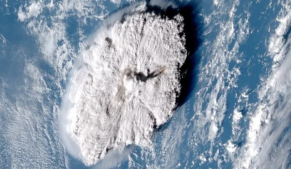
The plume reached an altitude of 57 kilometers at its greatest extent, according to the findings. This is significantly greater than the previous record-holders: the 1991 eruption of Mount Pinatubo in the Philippines (40 km at its highest point) and the 1982 eruption of El Chichón in Mexico (31 km). It is also the first observational evidence of a volcanic eruption injecting material through the stratosphere and directly into the mesosphere, which begins about 50 km above the Earth’s surface.
Lead author Dr Simon Proud (University of Oxford, RAL Space and the National Centre for Earth Observation), said: ‘It’s an extraordinary result as we have never seen a cloud of any type this tall before. Furthermore, the ability to estimate the height in the way we did (using the parallax method) is only possible now that we have good satellite coverage. It wouldn’t have been possible a decade or so ago.’
The Oxford researchers plan to build an automated system that uses the parallax method to calculate the heights of volcano plumes. ‘We’d also like to apply this technique to other eruptions and develop a dataset of plume heights that volcanologists and atmospheric scientists can use to model the dispersion of volcanic ash in the atmosphere,’ said co-author Dr. Andrew Prata from the Sub-department of Atmospheric, Oceanic & Planetary Physics. We’d like to know why the Tonga plume rose so high in the first place. What effects will this eruption have on the climate? What exactly was the plume made of?’