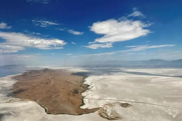
The Bonneville Salt Flats are a one-of-a-kind landform on the planet. The salt flats are approximately 12 miles long and 5 miles wide, and are mostly made up of sodium chloride, or table salt. The Salt Flats are a 30,000-acre expanse of hard, white salt crust on the western edge of Utah’s Great Salt Lake Basin, located 120 miles west of Salt Lake City in Tooele County.
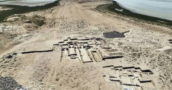
The Salt Flats, like the Great Salt Lake, are a remnant of Lake Bonneville, which covered over one-third of Utah between 10,000 and 32,000 years ago. The salt flats are listed on the National Register of Historic Places, are a Critical Environmental Concern, and are managed as a Special Recreation Management Area.
A treeless expanse of pristine white salt crystals in the Utah desert has long drawn daredevil speed racers, filmmakers, and social media-obsessed tourists. It’s so flat that visitors swear they can see the curvature of the earth on certain days.
The gleaming white terrain of the Bonneville Salt Flats, a remnant of a prehistoric lakebed and one of the American West’s many other-worldly landscapes, serves as a racetrack for land speed world records and the setting for films such as “Independence Day” and “The World’s Fastest Indian.” But it’s getting thinner as those who cherish it demand changes to save it.
The briny water in the aquifer beneath the flats is depleting faster than nature can replenish it, according to research. Evaporation yields less salt as nearby groundwater replaces the mineral-rich brine, compared to historic cycles of flooding and evaporation left on the landscape.
In Utah, after three decades of studies examining the salt flats, nothing has slowed the deterioration. But officials are funding a new study as they try to find a solution. Researchers are seeking to pinpoint why the salt is fading and what can be done to stop it.
In the last 60 years, it has shrunk by roughly one-third. The overall footprint has shrunk to roughly half of what it was in 1994. Unless seasonal flooding fails to recede or leaves behind an unstable layer of salt, the crust keeps tires cool at high speeds and provides an ideal racing surface. With only 8 miles of track compared to 13 miles (20 kilometers) several decades ago, racers struggle to find a track long enough to reach record speeds.
Scientists largely agree that years of aquifer overdraws by nearby potash mining have driven the problem, yet insist that there’s no hard evidence that simply paying the mining company to return water to the area will solve it amid detrimental human activity like extracting minerals or driving racecars.
Potash is potassium-based salt primarily used throughout the world as a fertilizer for crops such as corn, soy, rice and wheat. It’s extracted in more than a dozen countries throughout the world, mainly from prehistoric lakebeds like Bonneville’s. It’s mined from other iconic salt flats, including in Chile, where the thickness is not shrinking in a similar manner.
In Utah, after three decades of studies examining the salt flats, nothing has slowed the deterioration. But officials are funding a new study as they try to find a solution. Researchers are seeking to pinpoint why the salt is fading and what can be done to stop it. Under a $1 million research project spearheaded by the Utah Geological Survey, scientists are gathering data to understand the effects climate change, racing, repaving the salt, and operating the mine on leased federal land have on preserving the Salt Flats.
The salt is thinning as climate change drags the West into its third decade of drought, yet it’s unclear how that affects the seasonal flood patterns the landscape relies on to maintain its size and footprint.
Frustration is boiling over for Dennis Sullivan, a car-builder and racer who set a land speed record in his 1927 Model T street roadster. His organization, the Salt Flats Racing Association, is convinced the potash mining company that extracts minerals from the flats is the primary reason that the aquifer is being depleted. But rather than point fingers that direction, he and other racers blame the U.S. Bureau of Land Management, which oversees the area and is required by federal law to balance multiple uses and preserve it now and into the future.
To save the landscape, Sullivan says, the U.S. government needs to find $50 million over 10 years to pay Intrepid Potash, the mining company, to pour briny water it’s drawn from the land back on to the flats. He bristles at seeing more time and money spent on research when to him the solution is clear.
“In the world I came from, you study something, you figure out what changes you need to make, you make the changes and then you go back and study it again to see if your changes had an effect on it,” said Sullivan. “It’s ludicrous to just keep studying it until you do something.”
The fragile landscape has become less reliable for racers, who had to cancel “Speed Week” events scheduled for this fall after the salt flats flooded and left them without enough space to drive on. Though racers insist the answer is obvious, scientists contend that there’s no hard evidence that simply returning briny water will reverse the effects of extraction and maintain the salt flats. Sullivan doesn’t blame Intrepid Potash; it has a leasing agreement with the federal government. He says land managers haven’t invested in preserving the landscape or replenishing the salt taken off of it.
The Associated Press did not receive a response from Intrepid Potash. Jeremiah Bernau, a geologist with the Utah Geological Survey working on the study, said the mining company has already been pouring salt, but it’s unclear if that’s the solution. According to a 2016 study, the areas most vulnerable to thinning are those where races are held. In layman’s terms, it alters the flow of water through the crust, according to Bernau.
Supporters of the current study hope that if it is successful, the federal government will consider returning more salt to avoid conflict and allow the racers and miners to continue as they have.
If the study shows that salt laydown is effective, Utah state geologist Bill Keach expects racers to use the findings to lobby for federal funding to continue the project. When Utah lawmakers approved the initiative in 2019, they allocated $5 million on the condition that the federal government also contribute funding to return the briny water required to preserve the salt crust.
U.S. Rep Chris Stewart, who represents the area, assured Handy his office was working to secure the funds. Without hard evidence the salt laydown would restore the crust, the $45 million hasn’t materialized but Stewart said in a statement that he “remains absolutely committed to finding science-based solutions” to save the crust. Utah clawed back the majority of the funding after it got no matching federal funds.
“They’re doing what they can with $1 million, which hasn’t spread nearly far enough,” Handy said, noting that it was ultimately the federal government’s responsibility to manage the land, not Utah’s.
While solutions and the extent to which various parties are responsible are debatable, no one can deny that the landscape is a treasure worth preserving. Kneeling, the crust of fused crystals resembles popcorn. From a distance, the surface appears to be moon-like, and it attracts hundreds of visitors each day, some of whom arrive in brightly colored dresses at sunset in search of the perfect photograph.