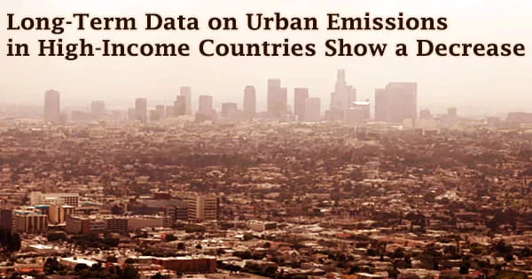
New research uses the latest improvements in the European Commission’s Joint Research Center’s Emissions Database for Global Atmospheric Research to illustrate how urbanization has affected anthropogenic CO2 and air pollutant emissions across all global regions. According to the findings, metropolitan areas were responsible for a third of worldwide anthropogenic greenhouse gas emissions and the bulk of air pollutant emissions by 2015.
The researchers utilized the EDGAR database to give a country-to-global picture of the evolution of sector-specific air pollutants and greenhouse gas emissions from urban centers and other geographical entities for various forms of human settlement during the last five decades. Their findings were published in the IOP Publishing journal Environmental Research Letters on July 6th.
Cities absorb 78 percent of the world’s energy and emit more than 60 percent of greenhouse gas emissions, according to UN-Habitat. Despite this, they make up less than 2% of the Earth’s surface. Because of the sheer number of people who rely on fossil fuels, metropolitan populations are particularly sensitive to the consequences of climate change. The situation is exacerbated by the lack of green places.
The worldwide population expanded by 80% between 1975 and 2015, with the global urban population nearly doubling while the global rural population increased by just 40%. All continents saw growth in urban population. The developing and rising areas saw the fastest urban population increase.
By 2015, urban centers were home to nearly half of the world’s population, with the largest urban centers with more than 1 million inhabitants (representing only 5% of the global surface) housing 22% of the world’s population.
From a sustainability standpoint, the ability to identify the kind, location, and source of emissions is critical for tailoring emission reduction plans and appropriately assessing population exposure.
The consolidated version 5 of EDGAR reflects the state of the art among emission inventory communities, describing current and past emissions of air pollutants and greenhouse gases at the global, regional, and national levels. Between 1970 and 2015, EDGAR offers worldwide spatial and temporal homogeneous consistent greenhouse gas and air pollutant emissions data.
EDGAR geographically distributes human emissions over a worldwide grid map with a spatial resolution of 0.1 degrees (approximately 10 km), allowing researchers to investigate where emissions occur and assisting in the creation of place-based mitigation methods from the global to the local level.
The findings reveal that metropolitan areas contribute significantly to global air pollution and CO2 emissions. Expanding the definition of metropolitan areas to include suburbs, about half of all global emissions occur in less than 1% of the world’s surface area.
Around 70-80 percent of global emissions are included when all metropolitan regions, not just urban centers, are considered. The majority of them are powered by combustion sources. Because these emissions are spatially concentrated, geographically focused mitigation activities can help. The lone exception is NH3, for which rural regions account for more than half of worldwide emissions, which are mostly related to agricultural operations.
In the last five decades, emissions in metropolitan areas have climbed dramatically in emerging nations, but have declined in high-income economies; CO, SO2, and PM10 emissions in industrialized countries decreased, due to higher energy efficiency and the implementation of new technologies and abatement measures.
Emissions from megacities have been decreased in high-income nations as a result of successful mitigation measures, de-industrialization, and the rise of the service sector. Finally, at the global level, per-capita urban CO2 emissions reveal geographical disparities among nations and cities; high-income countries have decoupled their emissions from economic development.
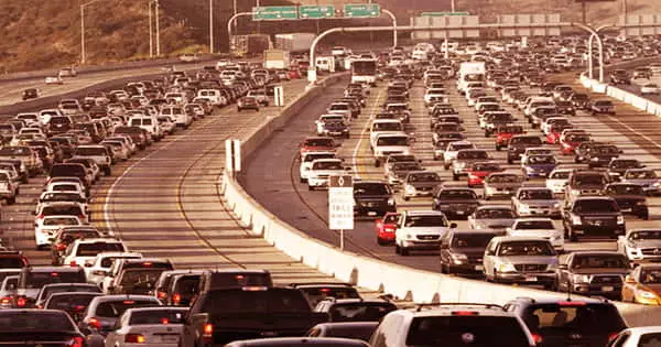
In metropolitan regions, automobile traffic pollution is a major source of health problems. Because the incidence and consequences of urban traffic and pollution are dependent on the geographical distribution of economic activity, households, and transportation linkages, they are basically geographic in nature.
Climate change has a greater impact on poor and low-income communities, in part because many of them live on the margins of society, in unstable structures, and in areas more vulnerable to flooding, landslides, and earthquakes, but also due to insufficient capacities, resources, and access to emergency response systems. In underdeveloped nations, this is much more pronounced.
While climate change is a worldwide concern, air quality is a more local issue that involves limiting urban population exposure to dangerous pollutants in order to reduce the impact on human health and ecosystems. As a result, both climate and air pollution-related local activities are required.
From this perspective, city-level activities can be successful in lowering PM2.5 population exposure; in at least half of the European cities studied, a 30 percent decrease in PM2.5 exposure can be accomplished by municipal initiatives.