A Category 5 typhoon is the most severe classification on the Saffir-Simpson Hurricane Wind Scale, which is used to measure the intensity of tropical cyclones, including typhoons. A Category 5 typhoon is characterized by sustained wind speeds of 252 kilometers per hour (157 miles per hour) or higher. These powerful storms can cause catastrophic damage, including widespread destruction of buildings, infrastructure, and vegetation.
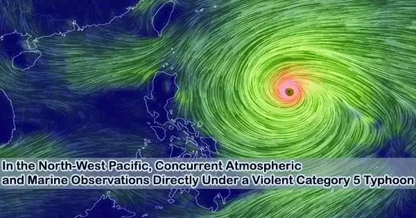
Nippon Telegraph and Telephone Corporation (NTT, Head Office: Chiyoda-ku, Tokyo; President & CEO: Akira Shimada) and the Okinawa Institute of Science and Technology (OIST, Head office: Onna-son, Kunigami-gun, Okinawa, Japan, Acting President: Dr. Albrecht Wagner) have successfully conducted the world’s first simultaneous marine and atmospheric measurements at multiple locations directly beneath a violent, Category 5, which is the strongest class, typhoon in the North-West Pacific, before it reached land.
These observations were made directly beneath typhoon No. 11, called “Hinnamnor”/”Henry,” in the summer of 2022. In addition to employing observational data from directly beneath typhoons to explain the mechanics of interaction between the atmosphere and ocean, NTT and OIST intend to continue their collaborative research in this area.
Background
Typhoons, which can have significant consequences on society and the environment, have recently become stronger and have done more harm as a result of global warming and other effects of climate change.
It is crucial to have an accurate grasp of the storm conditions at the time of landfall in order to adequately prepare for a typhoon. While a typhoon is still over the water, it is currently impossible to determine with any degree of accuracy from the satellite photos and other observations that are currently available. As a result, the accuracy of the information provided in weather reports about typhoons is restricted and is based on an analysis of weather satellite photos.
In 2017, a nationwide research project employed aircraft to conduct direct observations in an effort to increase forecast accuracy. This experiment showed how typhoon forecast accuracy may be improved by using observation data from aircraft.
In 2013, OIST made marine and atmospheric observations directly under a very strong Category 4 typhoon (Typhoon No. 24, “Danas”) using a Wave Glider (model SV2) from Liquid Robotics Inc., an autonomous, unmanned surface vehicle which they nicknamed “OISTER.”
This study accurately depicted the crucial conditions at the ocean’s surface, just beneath the typhoon. With stronger typhoons, it has proven impossible to undertake such observations because the weather becomes too dangerous.
Typhoon research has grown more crucial as a result of a changing environment that is fostering intensification. This is demonstrated by the creation of Japan’s only typhoon research facility in 2021.
NTT and OIST started working together on a cooperative project in 2021 to observe the variables needed to forecast typhoons even in the challenging conditions of a powerful typhoon. In 2022, NTT purchased a new Wave Glider (model SV3) which was called “Seiuchi-san” and began typhoon observations using both Wave Glider devices .
Key results:
- Successful observation of various factors important in predicting typhoon intensity.
- Sudden drop in air pressure near the center of the typhoon (violent wind region).
- Drop in seawater temperature in two areas (violent and strong wind regions) due to churning by the typhoon. Sudden increase in significant wave height near the center of the typhoon (in the violent wind region).
These are described in more detail in the next section.
Demonstration overview
Typhoon Hinnamnor began on August 28, 2022, near the island of Minamitorishima, with air pressure dropping to 920 hPa as it moved westward and became a violent, Category 5 typhoon. After checking the predicted path of the typhoon, the two Wave Gliders were put into operation.
Seiuchi-san operated in the violent wind region, not less than 11 km from the typhoon center (with average wind speeds of 25 m/s or more), and OISTER operated in the strong wind region approximately 100 km from the center (with average wind speeds of 15 m/s or more). Both vehicles took atmospheric and ocean measurements simultaneously.
Seiuchi-san was able to record abrupt, quick changes in air pressure in the typhoon’s severe wind zone. Air pressure is directly related to typhoon severity. At roughly 20:00 on August 31, when it was closest to the typhoon, it was able to confirm the lowest pressure figure. OISTER, on the other hand, took observations in the area of severe winds but was unable to spot such declines.
These trials were also able to track variations in sea water temperature, which is crucial for determining a typhoon’s intensity. Another crucial factor in accurately predicting intensity is changes in sea temperature, which have an impact on the typhoon’s energy source and correspond with the power of the typhoon. With Seiuchi-san near the center of the typhoon, the scientists were able to detect that the drop in sea-water temperature (approx. 2°C) occurred more suddenly.
Seiuchi-san also measured a maximum wave height of approximately 9 m. Since wind generates waves, estimating wind intensity can be done using the wave height. As a result, statistics on wave height from directly beneath a typhoon are useful, but they have proven challenging to gather through satellite observations.
The data also showed changes in the speed of ocean currents as the typhoon passed. Additionally, the researchers evaluated chlorophyll a concentrations, which are important for evaluating phytoplankton, and salt concentrations related to nutritional salts. In the future, the team intends to conduct a more thorough investigation of the impacts of typhoons.
These results were published in the May 22, 2023 issue of Scientific Online Letters on the Atmosphere (SOLA), by the Meteorological Society of Japan, which has been leading meteorological research since it was established in 1882.
Title Simultaneous Observations of Atmosphere and Ocean Directly under Typhoons Using Autonomous Surface Vehicles
In addition to gathering information on the atmosphere and water, the studies also recorded information about the Wave Gliders’ own behavior, including orientation and movement. In order to maintain steady observations in the future, the scientists will evaluate this behavior data and use it to upgrade their observational tools. Additionally, they intend to keep gathering and validating observational data and creating theories to explain how the atmosphere and oceans interact.
Future prospects
The goal of the research team is to develop techniques for making typhoon observations and to enhance typhoon prediction models by illuminating the mechanisms at play in typhoons. This will make it possible for scientists to examine and forecast typhoon conditions more precisely before they make landfall.
The researchers also intend to engage with numerous facilities and industries in the future to improve techniques for real-time typhoon observation and use them in Earth Information Analysis Infrastructure Technology using the Space Integrated Computing Network. They will also aid in the development of a resilient society capable of coexisting with typhoons by making proactive environmental adjustments based on incredibly precise typhoon forecasts.
The researchers hope to gain a better understanding of the global environment and be better able to encourage behavioral changes in our society to preserve and regenerate the Earth by using observation data to understand the effects of global warming on typhoons and conversely, the effects of typhoons on the global environment.