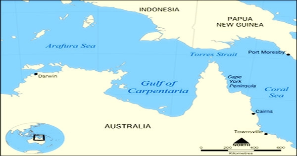
A large, comparatively uninhabited area in northern Queensland, the Gulf of Carpentaria (/kɑːrpənˈtɛəriə/, 14°S 139°E) is home to some of Australia’s most significant unaltered river systems, wetlands, and marine habitats. The Arafura Sea is a component of the Pacific Ocean. In the Northern Territory, between the Cape of York Peninsula and Arnhem Land, there is a gulf that is thought to be 300,000 square kilometers in size.
It is believed that the Gulf is an epicontinental sea (a shallow water body atop a continent). After being ignored for many years, the gulf only gained attention internationally in the late 20th and early 21st centuries when its bauxite, manganese, and prawn (shrimp) resources were exploited. From Slade Point in Queensland (the northwest corner of Cape York Peninsula) in the northeast to Cape Arnhem on the Gove Peninsula in the Northern Territory (the easternmost point of Arnhem Land) in the west, is the general definition of the northern boundary.
The Gulf of Mexico is 590 km (370 mi) broad at its mouth and 675 km (420 mi). The north-south distance is more than 700 kilometers (430 mi). It covers roughly 300,000 km2 of water (120,000 sq mi). The average depth is from 55 to 66 meters (30 to 36 fathoms), however, it never goes deeper than 82 meters (45 fathoms).
Northern Australia is home to the Gulf of Carpentaria, which borders Queensland and the Northern Territory. It is located between the Gove Peninsula of Arnhem Land on the west and the Cape York Peninsula of the east. In the Gulf of Carpentaria, the tidal range varies between two and three meters (6.5 and 10 ft).
At the height of the last ice age, 18,000 years ago, when the global sea level was around 120 m (390 ft) below where it is today, the Gulf and the nearby Sahul Shelf were dry lands. The Arafura Sea in the Pacific Ocean divides the gulf from New Guinea Island to the north, and the Cape York Peninsula and Torres Strait divide it from the Coral Sea to the east.
The Gulf Country refers to the area around the southern shore. The line between Cape Arnhem (Arnhem Land’s easternmost point) and Slade Point (Cape York Peninsula’s northwest corner) is the accepted definition of the northern limit of the gulf. A province of underwater coral reefs in the Gulf was only acknowledged in 2004.
The Gulf region experiences hot, rainy summers and colder, dry winters due to its tropical monsoonal climate. The area contains the Mitchell, Gilbert, Staaten, and Norman River catchments. The region has a strong Aboriginal cultural heritage, which adds to its tremendous cultural significance.
The immense western plains of Queensland slope into the gulf in a relatively gentle fall of only one foot per mile, indicating the extremely low gradient of the gulf floor. The plains become a band of salt flats as they go closer to the ocean; these flats are widest about west of the Flinders River.
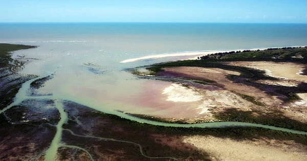
There are around 20 rivers that empty into the Gulf of Carpentaria; their lower courses are winding and feature large deltas. The Gulf’s biological landscape is remarkably unaltered when compared to most other parts of Australia.
However, the area has changed significantly over the past 200 years and is frequently sought after by businesses and governments as a potential location for growth and resource extraction. The destructive industries that have wreaked havoc on much of southern Australia’s ecology must not be allowed to spread to areas like the Gulf.
It is necessary to develop new sectors and economies that respect and value the region’s significant natural and cultural features. Between 1605 and 1628, the Dutch were the first to explore the eastern side of the gulf; in 1644, the explorer Abel Tasman discovered the southern and western coasts. Pieter de Carpentier, the governor-general of the Dutch East Indies (1623–27), was honored with a name for the gulf.
The largest island in the gulf is Groote Eylandt, which is situated 50 kilometers east of the Northern Territory. The gulf is home to coral colonies and bordering reefs in addition to the islands. Grazing pressure poses a serious danger to biodiversity, water quality, and land condition in the Gulf region.
Finding “areas of least disturbance” has some significant advantages because the Gulf is already heavily used for grazing. In the tropical savannas, these valuable places are uncommon, but they could serve as the center or focal point of some future conservation planning, such as that for the Staaten River watershed.
At least 20 rivers, including the Roper, Wilton, Walker, Calvert, Flinders, McArthur, and Norman Rivers, flow into the Gulf of Mexico. The Gulf region has two distinct seasons and a hot, humid climate. The wet season lasts from December to March, and the dry season is from April to November.
The Carpentaria tropical savanna, the biggest unbroken savanna forest in the world, as well as natural grasslands, are both found in the Gulf Country. The Gulf’s west and east coasts are also covered in woods. Eucalyptus and Melaleuca species from the Myrtaceae family predominate there.
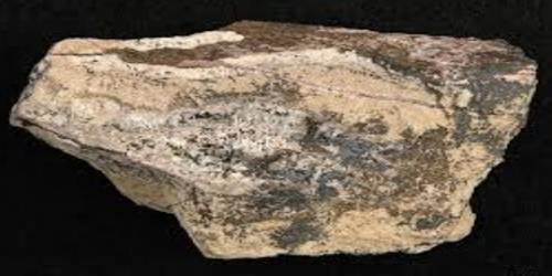
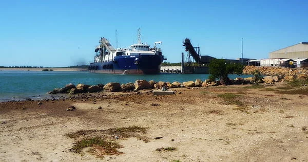
The Gulf encompasses a continental shelf that is shared by Australia and New Guinea. The gulf’s floor has a mild descent into it from Queensland’s western plain, which has a low grade. Sandstone beds are overlain by strata of bauxite that are roughly 10 meters thick throughout the Gulf of Carpentaria shoreline, particularly on the Sir Edward Pellew and Wellesley islands.
Tropical cyclones are more likely to form in the Gulf between November and April. The gulf experiences three cyclones on average every year, which are hypothesized to move sediments clockwise along the coast of the Gulf. The Gilbert River presents several challenging problems.
There has been irrigated agriculture there for the past 50 years. The resilience of soils to continuous cropping, retention of only minor riparian strips, and salinity on some of the sandy earth that are currently being suggested for irrigation expansion are some crucial challenges that need to be addressed.
Starting in the late 1960s, prawn fishing in the Gulf expanded quickly. The fishing for prawns industry is centered in the town of Karumba, which is situated at the southeasterly tip of the gulf. The influence of grazing in riparian and nearby areas may currently be more significant than irrigation and water infrastructure in terms of managing wild rivers.
While there are no mountains in the Gulf Country to limit rainfall to the coastal strip, there is a progressive change from the profuse tropical flora of the coastline regions to the arid scrubs of central Australia. The area around the gulf was previously populated by various aboriginal Australians who primarily spoke Aboriginal languages including Yulluna and Kayardild before the arrival of the European explorers.
The area was first explored by a European, Willem Janszoon of the Netherlands, during his expedition in 1605–1606. Another Dutchman, Jan Carstensz, visited the area in 1623 and gave the area the name “Carpentaria” in honor of Pieter de Carpentier, the governor-general of the Dutch East Indies at the time. Abel Tasman began exploring the southern and western coast in 1644 after the initial Dutch explorers who came to the region between 1605 and 1628 primarily explored the eastern side.
It has been proposed that a significant asteroid impact event occurred in the Gulf in 536 AD. The lack of information regarding its biological values hampered the assessment, planning, and management of the Gulf region’s natural heritage. Although there are scattered coral colonies and surrounding reefs in the Gulf of Carpentaria, there are currently no patch or barrier reefs there.
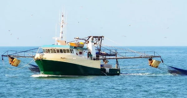
It is crucial to support plans to conduct more thorough flora and fauna surveys over the entire Gulf region. The Gulf, supports significant commercial and recreational fisheries the most of which are very reliant on the condition of the local rivers. Large seagrass beds have made it possible for Gulf commercial shrimp operations.
The rivers not only sustain a fishing tourism economy but they also regularly flood, providing vital freshwater and nutrients to populations of marine prawns. The Gulf region’s economy also heavily relies on the cattle business. The wider (and surrounding) Carpentaria Basin province, which is itself a component of the greater East Australian Basins physiographic division, contains several unique physiographic divisions, one of which being the Gulf.