A new map of the Schrodinger basin, a geologically significant area of the moon, that includes rover paths, could help guide future exploration missions. A team of interns at the Lunar and Planetary Institute created the map, including Ellen Czaplinski, a University of Arkansas graduate student researcher at the Arkansas Center for Planetary Sciences and first author of a paper published in The Planetary Science Journal.
A team of interns at the Lunar and Planetary Institute created a new lunar map after identifying significant geologic features of the Schrödinger basin, which is located near the lunar south pole.
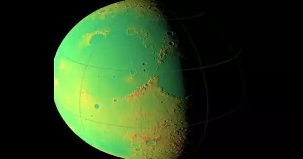
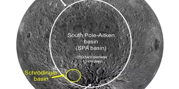
Schrödinger basin, the moon’s second-youngest impact basin, is near the lunar south pole. It has a number of crustal features and rock types that are crucial to understanding the moon’s geological history. The geologic features of the Schrödinger basin, which is located near the lunar south pole, were identified by the researchers. Schrödinger is the moon’s second-youngest impact basin, with a diverse range of crustal features and rock types important for understanding the moon’s geological history.
Along with the map, the researchers devised three potential paths for robotic rovers to take to collect high-priority rock samples in the Schrödinger basin. The map was used by the researchers to create three possible paths for robotic rovers to take through the Schrödinger Basin in order to collect high-priority rock samples.
Ellen Czaplinski
“Some of these lithologies (the general physical characteristics of the rocks) may have been uplifted from very deep beneath the lunar surface when the Schrödinger basin was formed,” Czaplinski said. “As a result, investigating these rocks up close is critical for answering high-priority science goals.”
The National Research Council outlined the scientific objectives and goals of future lunar missions in 2007, including the exploration of the South Pole-Aitken basin, the moon’s oldest and deepest impact basin. Because the Schrödinger basin is located within the South Pole-Aitken basin, it provides a unique opportunity to study rocks that may have formed deep beneath the surface, according to Czaplinski.
“Many of these rock types are visible at the surface in multi-kilometer-long exposures of rock outcrops in Schrödinger’s ‘peak ring,’ an inner ring of uplifted rocks formed with the basin. The sampling of these rocks within the peak ring has a high scientific potential for furthering our understanding of the context of Schrödinger’s lithologies.”
Along with the map, the researchers devised three potential paths for robotic rovers to take to collect high-priority rock samples in the Schrödinger basin. The map was used by the researchers to create three possible paths for robotic rovers to take through the Schrödinger Basin in order to collect high-priority rock samples. The geological features of the Schrödinger Basin, which is located near the lunar south pole, were identified by the researchers. Schrödinger is the Moon’s second-smallest impact basin, and it contains a variety of crustal features and rock types that are important for understanding the Moon’s geological history.
“Some of these lithologies (general physical characteristics of the rocks) may have been elevated above the very bottom of the lunar surface when the Schrödinger Basin was formed,” Kazaplinsky said. “As a result, it is critical to closely examine these rocks in order to answer high-priority science goals.”
The National Research Council laid out the scientific objectives and goals of future lunar missions in 2007, including the discovery of the South Pole – Aitken Basin, the Moon’s oldest and deepest impact basin. Because the Schrödinger Basin is located within the South Pole – Aitken Basin, it provides a unique opportunity to study rocks that likely formed deep beneath the surface, according to Kazaplinsky.
“Many of these rocks are exposed on the surface in multi-kilometer-long outcrop exposures in Schrödinger’s ‘peak ring,’ an inner ring of uplift rocks formed along the basin.” These rocks are located within the peak ring. The sample has a high scientific potential for furthering our understanding of Schrodinger’s context of lithology.
The map was used by the researchers to create three possible paths for robotic rovers to take through the Schrödinger Basin in order to collect high-priority rock samples.