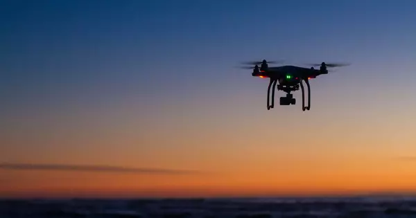
The use of drones to monitor the sea floor is an exciting development in oceanographic research. Traditional methods of ocean floor exploration, such as the use of manned submersibles or remotely operated vehicles (ROVs), can be costly, time-consuming, and limited in their coverage. Drones, on the other hand, offer a more cost-effective and efficient alternative for collecting data in a way that was previously impossible.
A novel method for measuring the earth’s crust on the seafloor has been developed by researchers. On a sea-surface landing unmanned aerial vehicle, a lightweight geodetic measurement device was mounted (UAV). This new system’s mobility will allow for the rapid and efficient collection of real-time deep seafloor information, which is critical for understanding earthquake risk, as well as a variety of other oceanographic observations.
Understanding earthquake risk requires measuring the position and topography of the earth’s crust. Researchers led by The University of Tokyo’s Institute of Industrial Science have developed a novel method for monitoring the position of the seafloor using a drone-based observation device that could revolutionize oceanographic observation.
Seafloor stations need to communicate with vessels or buoys at the surface that, in turn, communicate with satellites to produce accurate positional information. But ocean conditions limit the mobility and speed of vessels at the surface.
Professor Yokota
Changes in the earth’s surface occur as a result of tectonic forces accumulating in the crust, a process known as crustal deformation. When the forces exerted on the crust (stress) by the movement of tectonic plates exceed the strength of the rock, it can change shape. Measuring these changes (geodetic measurements) can reveal underlying tectonic processes and provide insights into seismic risk. However, 70% of the earth’s surface is underwater, posing a unique set of monitoring challenges.
“Measurement of the seafloor has traditionally been conducted using buoys or ocean-going vessels,” explains co-author Professor Yokota. “Seafloor stations need to communicate with vessels or buoys at the surface that, in turn, communicate with satellites to produce accurate positional information. But ocean conditions limit the mobility and speed of vessels at the surface.”
To address some of these challenges, the team developed a sea-surface landing unmanned aerial vehicle (UAV) as a sea surface monitoring device. A lightweight measurement device was mounted on the UAV, which moves over the sea surface and communicates with seafloor observation stations. The advantages of this system are the speed and efficiency of obtaining deep seafloor information.
“Because of the mobility of this UAV, deep geodetic measurements can be acquired much more quickly and efficiently than before,” says co-author Professor Hirakawa. “Such high-speed UAV observation in the sea will not only aid in disaster prevention, but will also aid in the operation of autonomous underwater vehicles/remotely operated vehicles, as well as enable frequent marine biological and fisheries science observations.”
The team’s next steps include more sea testing of the UAV and further development of autonomous navigation and observation technology. Given the devastation that earthquakes and tsunamis can cause, accurate information that can aid in prediction, such as that obtained by UAVs, is critical.