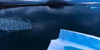
Moss beds are important indicators of climate change in Antarctica as they are sensitive to changes in temperature and moisture levels. Drones equipped with high-resolution cameras can be used to capture images of the moss beds, which can then be analyzed to detect changes over time. These images can also be used to create 3D models of the moss beds, which can provide a more detailed view of the moss distribution and changes.
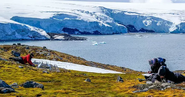
Drones with advanced sensors and artificial intelligence (AI) are being used by researchers to map large areas and study changes in Antarctica’s climate. With the assistance of the Federal Government’s Australian Antarctic Division, researchers have been using drones to map large areas of Antarctica this summer in an effort to monitor the effects of climate change on vegetation.
Researchers from QUT and Auckland University of Technology, with assistance from the University of Wollongong, are using drone imagery to assess the fragile ecosystem, particularly moss beds, and changes in the extreme environment. The field team was based in Antarctica for nearly two months, with indications that the drones they piloted captured unprecedented high-resolution imagery of vegetation and biodiversity in protected areas.
Drones could increase the likelihood of successful data collection by allowing remote and fragile ecosystems to be surveyed with minimal impact and can mitigate some accessibility issues.
Ms. Burrows
The vision, captured near the scientists’ base settlement of Casey Station in Australian Specially Protected Areas (ASPAs 135 and 136), identified areas with moss and lichen not previously detected by satellite.
Dr. Juan Sandino, a QUT Centre for Robotics researcher who specializes in mechatronics and automated remote sensing systems, assisted in the development and deployment of drones that classified Antarctic vegetation at low altitudes.
“Piloting these flights was at times challenging; however all the systems performed well under extremely cold conditions,” he said. He said working in Antarctica demanded rigorous physical preparation and had additional logistical pressure of ensuring the heavy equipment was operational.
The seven-year $3.57 million project is co-led by QUT Professor Felipe Gonzalez and Auckland University of Technology Professor Barbara Ballard. The project’s key aims included monitoring the vegetation through smart sensors and artificial intelligence, modeling microclimates, and producing accurate maps of protected areas and other ice-free regions.
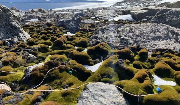
“Few plants can survive in Antarctica and mosses are the largest and oldest plants to grow there with beds up to 50 meters wide and plants as old as 500 years,” Professor Bollard said. “The moss is sensitive to variations of temperature and moisture in Antarctica and is an important indicator of climate change.”
According to Professor Gonzalez, mapping and monitoring moss beds over time will aid in understanding the health of mosses and other vegetation. The study is part of Securing Antarctica’s Environmental Future (SAEF), a $36 million research program funded as a special research initiative by the Australian Research Council.
Further drone imagery and AI for other Antarctic regions could be used to assess the effectiveness of area-based conservation interventions in more parts of the icy continent. The QUT study, which was recently published in Conservation Biology, presented a case study and a research agenda for assessing the conservation impact of Antarctica’s protected areas.
Ph.D. researcher Joanna Burrows and supervisor Professor Kerrie Wilson, both members of SAEF, identified a research gap regarding the effectiveness of Antarctic Specially Protected Areas (ASPAs). According to Ms. Burrows, drones can provide new and more detailed information to evaluate the performance of ASPAs.
“Drones could increase the likelihood of successful data collection by allowing remote and fragile ecosystems to be surveyed with minimal impact and can mitigate some accessibility issues,” Ms. Burrows said.