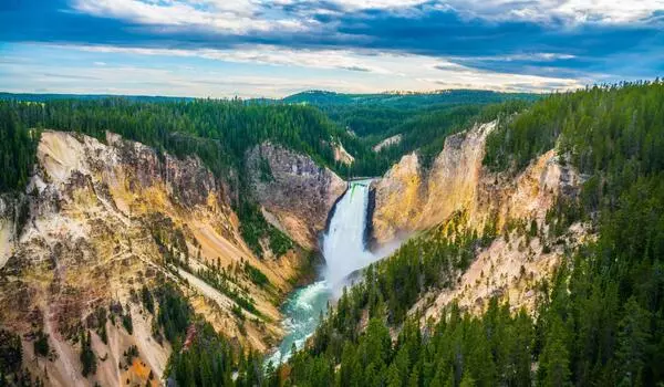
Thanks to a laser-equipped plane, a hidden landscape riddled with landslides is coming into focus in Yellowstone National Park. Yellowstone’s first national park was studied by scientists who crisscrossed it on foot and studied aerial photographs. However, researchers now have access to a massive new digital dataset that is shedding new light on this nearly 1-million-hectare natural wonderland.
These Yellowstone observations enabled a pair of researchers to pinpoint over 1,000 landslides within and near the park, hundreds of which had not previously been mapped, the researchers reported at the Geological Society of America Connects 2022 meeting. The majority of these landslides occurred thousands of years ago, but some are still active.
Landslides in Yellowstone are important to map because they can destroy infrastructure such as roads and bridges. The millions of visitors who visit Yellowstone each year enter through only a few entrance roads, one of which was recently closed for months due to severe flooding.
Landslides in Yellowstone are important to map because they can destroy infrastructure such as roads and bridges. The millions of visitors who visit Yellowstone each year enter through only a few entrance roads, one of which was recently closed for months due to severe flooding.
In 2020, a small plane flew a few hundred meters above Yellowstone’s otherworldly landscape. It wasn’t, however, transporting tourists eager for close-up views of the park’s famous wolves or hydrothermal vents. Instead, the plane carried a downward-pointing laser that fired pulses of infrared light at the ground. Researchers reconstructed the precise topography of the landscape by measuring the timing of pulses that hit the ground and reflected back toward the aircraft.
Such “light detection and ranging,” or lidar, data reveal details that often remain hidden to the eye. “We’re able to see the surface of the ground as if there’s no vegetation,” says Kyra Bornong, a geoscientist at Idaho State University in Pocatello. Similar lidar observations have been used to pinpoint pre-Columbian settlements deep within the Amazon jungle.
The Yellowstone lidar data were collected as part of the 3D Elevation Program, an ongoing project spearheaded by the United States Geological Survey to map the entirety of the United States using lidar.
Bornong and geomorphologist Ben Crosby used Yellowstone data — which can resolve details as small as one meter — to zero in on landslides. The team looked for areas where the landscape changed from relatively smooth to jumbled, indicating that soil and rocks had once been moving. “It’s a pattern-recognition game,” says Crosby, also of Idaho State University. “You’re looking for that contrast between the lumpy and smooth stuff.”
The researchers discovered over 1,000 landslides in Yellowstone, the majority of which were located near the park’s outskirts. According to Lyman Persico, a geomorphologist at Whitman College in Walla Walla, Wash., who was not involved in the research, this makes sense given the geography of Yellowstone’s interior. The park is built on top of a supervolcano, and previous eruptions covered much of the park in lava (SN: 1/2/18). “You’re in the middle of the Yellowstone caldera, where everything is flat,” Persico explains.
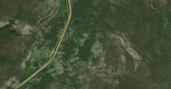
However, steep terrain abounds in the national park, and infrastructure exists in many of the landslide-prone areas. The team discovered that roads had been built over landslide debris in several places. Highway 191, for example, skirts the western edge of Yellowstone.
It’s worth keeping an eye on this highway since it funnels significant amounts of traffic through regions apt to experience landslides, Bornong says. “It’s one of the busiest roads in Montana.”
There’s plenty more to learn from this novel look at Yellowstone, Crosby says. Lidar data can shed light on geologic processes like volcanic and tectonic activity, both of which Yellowstone has in spades. “It’s a transformative tool,” he says.