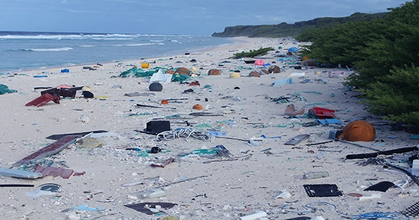
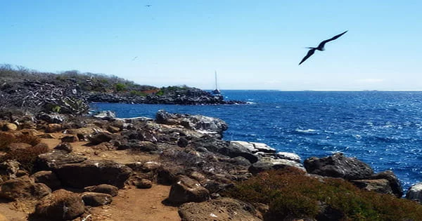
Henderson Island, a remote and deserted island in the Pacific Ocean, has been misrepresented on maps for 85 years, according to the British Royal Navy. The HMS Spey informed officials when it arrived in the vicinity that the island was really a mile south of where it was depicted on marine charts used by sailors since 1937. Henderson Island, located 3,600 miles (5,800 kilometers) west of Chile in the Pacific Ocean, has the unenviable distinction of “world’s most polluted island.” Henderson Island’s beaches are filled with man-made pollution, with an astounding 270 things washing up on its strand each day.
The Navy, like many other ships that cruise over open waters, employs computerized charts. While they are extremely accurate in heavily monitored areas, satellite data is used to establish the exact position of locales such as the Pitcairn Islands (which are practically squarely in the midst of the world’s biggest ocean). The fact that data for some of these islands may be inaccurate was brought up, and the HMS Spey, which was in the region, offered to help. HMS Spey is a River-class offshore patrol vessel, not a survey vessel, yet it used radar and navigational data to cross-reference the exact position of Henderson Island and spot the inaccuracy in current charts.
“In principle,” Lieutenant Michael Royle noted in a statement, “the picture provided by the radar should sit perfectly over the documented feature – in this case, Henderson Island.” “I discovered that wasn’t the case — the radar overlay was a mile distant from the island, indicating that the island was originally mapped in the wrong position.” The chart’s comments state that it was created using aerial photographs in 1937, which suggests that the airplane that took the images was somewhat wrong in its navigational calculations.”
The mistake was discovered on Thursday evening and has subsequently been corrected. Henderson Island is just 14.4 square miles (37.3 square kilometers) in size, but it is home to around 40 million pieces of plastic. Floating plastic accumulates at an alarming rate in the area, most likely as a result of incoming currents and its location in the middle of the Pacific. Scientists have gathered water samples in order to understand more about the secluded location and humanity’s influence on it. “Scientists in the UK have extremely little information on the ocean in this region, including salinity, temperature, and water pressure,” Lt Royle stated. “They’re interested in learning more about climate change in the area.”