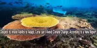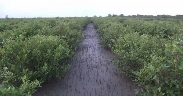
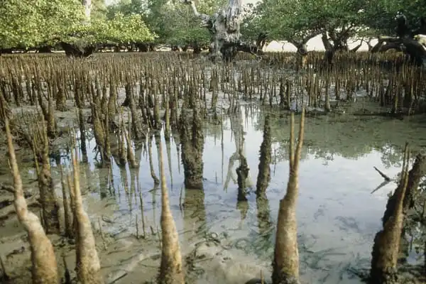
Mangrove trees help to stabilize the coastline and reduce erosion caused by storm surges, currents, waves, and tides. Mangrove forests are especially appealing to fish and other species looking for food and protection from predators due to their extensive root system. Coastal mangroves and saltmarshes have historically been devalued and regarded as wastelands by many. As a result, numerous regions have been flooded, reclaimed, degraded as a result of various human activities, or otherwise lost.
A new report published by an East Carolina University researcher in the Department of Coastal Studies sheds insight on the impact of man-made infrastructure and natural topography on coastal wetlands during large storm events. The work, directed by assistant professor David Lagomasino and conducted in collaboration with NASA and Florida International University, was published in the July issue of Nature Communications.
The research focused on the effects of Hurricane Irma, which hit Florida in 2017 and destroyed the state’s mangrove forests. The research team discovered that the woodlands experienced unprecedented dieback following the catastrophic cyclone.
Mangrove forests are frequently devastated following hurricanes, but according to Lagomasino, forests in Florida have demonstrated extraordinary resilience in the past due to their structure, location, and species composition. The woodlands did not recover at the same rate after Hurricane Irma. Following the storm, about 11,000 hectares – an area larger than 24,000 football fields – exhibited signs of full dieback.
Both man-made and natural changes in terrain can affect the flow of water through an area, Roads and levees, for example, can impede or stop the flow of water between formerly connected locations. Because there is no connection between the water, extremes can occur: severe dry conditions and extreme wet conditions, both of which can be taxing on wetland flora that flourishes in more stable settings.
David Lagomasino
That’s a serious problem for a resource that saves the state more than $11 billion in property and flood damage each year, according to Lagomasino. “There have been severe hurricanes in the past that have caused damage,” Lagomasino said. “However, Irma appears to have created one of the largest areas of dieback, at least in the satellite record.”
The research team was able to discover plausible explanations for the dieback after reviewing satellite and aerial imagery of the region. These hypotheses included human-made impediments.
“Both man-made and natural changes in terrain can affect the flow of water through an area,” Lagomasino explained. “Roads and levees, for example, can impede or stop the flow of water between formerly connected locations. Because there is no connection between the water, extremes can occur: severe dry conditions and extreme wet conditions, both of which can be taxing on wetland flora that flourishes in more stable settings.”
According to the study, human-made obstacles might increase the amount of time water stays on the surface, causing rapid breakdown of tiny root components. When storm surge is high and barriers block water flow, saltwater ponding may increase. These findings are critical not only for future storm planning in Florida, but also for other coastal states such as North Carolina, according to Lagomasino.
“What we learned in Florida may be applied to North Carolina and other coastal places,” said Lagomasino. “Our findings suggest that the elevation of the landscape, the connectedness of water across the landscape, and the height of storm surge can all be used to identify vulnerable locations. In other words, low elevation places that are isolated or lack the ability to drain after flooding are more vulnerable to long-term damage. This is useful for understanding the resilience of North Carolina’s coastal woods and wetlands, and it may also be beneficial in anticipating metropolitan areas, which may be less resilient to these extreme events.”
The study proposed several adjustments that may be implemented in the future to improve coastal resiliency in the face of severe weather events, including:
- Adding additional measures to the old hurricane rating system that account for storm surge and geology;
- Setting up field research stations in low-lying areas to aid in the identification of underrepresented physical and biological processes in susceptible places;
- Conducting frequent coastal remote sensing studies in order to monitor drainage basins and improve water connection; and
- Increasing freshwater flow to aid in the formation of new tidal channels.
“We believe that the information gleaned from our research will aid in the recovery process following storms,” Lagomasino added. “If these places can be recognized ahead of time, the disaster response can address difficulties in hard-hit areas considerably faster or reduce the damage ahead of time.”
“The main message from this is that strong winds cause a lot of damage during hurricanes. However, the severity of the damage does not always correspond to the system’s ability to recover over time. Other elements, such as modest elevation changes in the coastal landscape and storm surge, play a crucial effect in how the ecosystem heals or does not recover after the initial harm. Considering these elements ahead of hurricane season can assist reduce long-term damage in susceptible places.”