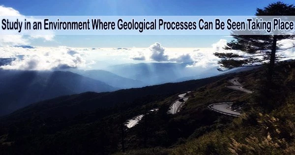
There is no place that comes close to Taiwan when it comes to examining certain geological processes in real time.
Taiwan has some of the quickest rates of mountain construction in the world; these mountains are expanding more quickly than our fingernails do in a year. The mountains also see frequent and significant earthquakes, the region experiences about four typhoons per year on average, and in some places, it receives upwards of several meters of rain annually, says UConn Associate Professor in the Department of Earth Sciences, Michael Hren.
All of these circumstances result from Taiwan’s location at the meeting point of the Eurasian and Philippine Sea plates, which creates an extreme landscape where you can watch the mountains eroding, rising, and tumbling on a human timeline. Hren’s team and their collaborators from the University of Oregon have applied novel techniques to understand this changeable mountain range’s past. Their findings are published in Science Advances.
“For decades Taiwan has been a place where people study the processes of how the earth works because everything is sped up a little bit. It’s also an archetypal example of an arc-continent collision, so it’s a model for the world, yet we know very little about the height of those mountains through time,” says Hren.
Because the topography, or physical features, of a mountain are the consequence of a balance between mountain building and erosion, it is crucial to know the height of mountains over time.
We’re working on further constraining that process in Taiwan, we’re also looking at basins or sediments throughout the island to develop a comprehensive picture of the entire island system to try and answer these questions. Was there a spatial gradient in the timing of uplift? Are there differences in the records between the east sides and the west sides as we think about different mountain systems there? That’s part of an ongoing project that we’re continuing in Taiwan.
Professor Michael Hren
Hren explains: “The height of mountains tells us about how or what the feedbacks are between processes in the atmosphere, climate, weathering, biology, and processes that are occurring deep in the earth. If we know the topography, and the height of mountains through time, and we also know what’s going on underneath the surface, then we can figure out how these things influence one another.”
We can learn more about how the global carbon cycle is affected by mountain uplift by studying these historic occurrences. For instance, carbon dioxide from the atmosphere can eventually be deposited in marine carbonate rocks as a result of weathering of silicate minerals in mountains.
Similar to how carbon dioxide created on land is transported to the ocean and stored there, according to Hren, is organic carbon. Both of these processes can impact long-term atmospheric carbon dioxide levels.
“If we don’t understand mountain evolution, then we don’t understand how tectonic processes are linked to the atmosphere and global climate,” Hren says. “Reconstructing the paleoelevation history of tropical mountain belts such as Taiwan has proved difficult because it is hot, it is wet, things erode quickly and most sediment is dumped into the ocean. There’s not a lot of the record left to study on land.”
With the shortage of tools for quantifying the paleoelevation of Taiwan, Hren’s research group, including Queenie Chang Ph.D. ’22, has taken a novel approach to looking back at the history of Taiwan’s mountains. The researchers gathered 39 samples of ancient material carried by rivers moving sediments away from the mountains from various locations throughout the Taiwan mountain belt.
“Sediments derived from the mountain were transported and accumulated on the river floodplains and deep marine basin. They were lithified into sedimentary rocks after millions of years,” says Chang. “Thanks to the rapid uplift rate in Taiwan, these layers of rock now are exposed on the surface for us to study and collect.”
They determined the isotope chemistry of the organic matter, which contains information on the altitude at which prehistoric plants flourished, in these sedimentary rocks from all of the ancient river system, providing evidence of the network’s history.
“We’re essentially trying to relate the chemistry of sedimentary organic matter to where the materials came from in this journey. These sediments are anywhere from three million years old to more recent and the chemistry can tell us about mountain evolution,” says Hren.
Hydrogen isotopes stored in leaf waxes, which are being measured by the researchers, record the water that dropped across the landscape before being absorbed by plants and other primary producers.
The data show a fundamental change in the chemistry of the sediments over time, reflecting changes in the landscape and illuminating the growth and development of the mountain ranges on Taiwan’s eastern side. Namely, they saw a rapid upshift in elevation of about two kilometers (roughly 1.2 miles) from about 1.3 to 1.5 million years ago to the present.
“Much previous geological evidence has shown a significant transition of tectonic activity in Taiwan at this time increasing sedimentation rate in the ocean, increasing rock exhumation rate, and a change in plate convergence orientation. Our findings show how these changes in tectonic activities influence the Earth’s surface landscape and the height of the mountains rapidly,” says Chang.
Hren says this approach yields the first real data for quantifying the evolution of how high the mountains were in Taiwan, and the technique can be applied to any tropical mountain belt.
The results of this study will assist clear up any confusion regarding Taiwan’s paleotopographic past. According to Hren, the age and development of the mountains were major topics of discussion. The limits provided by the isotope data can be expanded upon to shed more light on the development and evolution of the mountain range.
“There have been long-standing debates about not just when exactly the mountains went up, but also how they went up,” Hren says. “One traditional view has been that there was a southward migration of mountain building, then effectively, it started in the north and then continues to grow to the south. This is a part of addressing that question. The other part is about the timing, where some would argue for an older development, and some believe it just popped up in the last million years.”
Hren notes that this research is an international effort and was made possible because of a collaborative project with multiple students from Taiwanese universities and faculty members from across the U.S. With the constraints the data applies, the researchers are continuing their work to reconstruct the past and gain a better understanding of these geological phenomena that have so much bearing on how the rest of the planet functions.
“When you grow a mountain, much of the organic matter gets eroded and carried into the ocean and has big implications for the global carbon cycle,” says Hren. “We’re working on further constraining that process in Taiwan, we’re also looking at basins or sediments throughout the island to develop a comprehensive picture of the entire island system to try and answer these questions. Was there a spatial gradient in the timing of uplift? Are there differences in the records between the east sides and the west sides as we think about different mountain systems there? That’s part of an ongoing project that we’re continuing in Taiwan.”