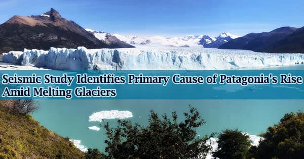
The Andes mountain range in Chile and Argentina is home to hundreds of kilometers of icefields, which are melting at some of the planet’s fastest rates. As these glaciers melt, the ground beneath the ice is likewise changing and rising.
Recent glacier mass loss, fast rock uplift, and the tectonic plate gap that underlies Patagonia have all been linked by geologists. One of the first seismic surveys of the Patagonian Andes has just been finished by researchers at Washington University in St. Louis, under the direction of seismologist Douglas Wiens, the Robert S. Brookings Distinguished Professor in Arts & Sciences.
They describe and map out regional subsurface dynamics in a recent article that was published in the journal Geophysical Research Letters.
“Variations in the size of glaciers, as they grow and shrink, combined with the mantle structure that we’ve imaged in this study are driving rapid and spatially variable uplift in this region,” said Hannah Mark, a former Steve Fossett postdoctoral fellow in earth and planetary sciences at Washington University, the first author of the publication.
At the Woods Hole Oceanographic Institution, Mark is now a postdoctoral researcher. The seismic data that Mark and Wiens investigated demonstrates how hotter, less viscous mantle material has been allowed to flow beneath South America through a breach in the down-moving tectonic plate about 60 miles beneath Patagonia.
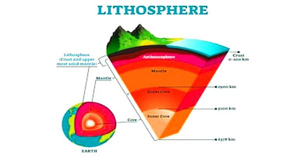
The icefields above this breach have been receding, taking the weight off the continent that had previously forced it to stretch downward. The gap’s interior and surroundings were determined to have very low seismic velocity, and the rigid lithosphere that covered the gap had thinned.
Many of the recent changes that have been seen in Patagonia are being caused by these specific mantle conditions, including the quick uplift of certain regions that were once buried in ice.
“Low viscosities mean that the mantle responds to deglaciation on the time scale of tens of years, rather than thousands of years, as we observe in Canada for example,” Wiens said. This explains why GPS has measured large uplift due to the loss of ice mass.
“Another significant thing is that the viscosity is higher beneath the southern part of the Southern Patagonia Icefield compared to the Northern Patagonia Icefield, which helps to explain why uplift rates vary from north to south,” he said.
Rebounding and rising
When glaciers melt, the weight they formerly carried off the land is greatly reduced. Water that was once frozen as ice is now flowing in vast quantities toward the seas. The newly relieved earth rises and rebounds.
The beautiful glaciers are being reduced in size. Over the coming decades, the ice fronts will recede higher up the mountains and farther into the interior, potentially making them more difficult to visit. I can easily see that the glaciers have shrunk since I first visited this area in 1996.
Seismologist Douglas Wiens
Geologists can find evidence of this ice mass change and uplift combination in various parts of the globe.
There are several reasons why the ongoing land movement known as “glacial isostatic adjustment” is important, but it matters most because it has an impact on forecasts for sea level rise under future climate warming scenarios.
One of the most intriguing findings of this investigation, according to Mark, was that the slab window beneath the portion of the Patagonia icefields that had recently opened up was where they located the hottest and least viscous portions of the mantle.
“This suggests to us that maybe the mantle dynamics associated with the slab window may have intensified over time, or that the continental plate in the south started out thicker and colder and so was less affected by the slab window than the part of the plate farther north,” Mark said.
The seismic study, which was supported by the National Science Foundation, was completed by Mark and Wiens in collaboration with colleagues from the California Institute of Technology/Jet Propulsion Laboratory, Universidad Nacional de La Plata, Southern Methodist University, and Universidad de Chile.
Since Patagonia is a sparsely populated, remote region with low earthquake risks, just a few seismic investigations have been done there in the past, according to Wiens. The information he and his team gathered is already being put to use for things other than this mantle imaging project.
More than 25 years ago, Wiens made his first trip to Patagonia. He claimed that the changes he has seen over his lifetime have astonished him.
“The beautiful glaciers are being reduced in size,” Wiens said. “Over the coming decades, the ice fronts will recede higher up the mountains and farther into the interior, potentially making them more difficult to visit. I can easily see that the glaciers have shrunk since I first visited this area in 1996.”
Ups and downs of field work in Patagonia
As part of a 2019 Undergraduate Field Geology course field trip, led by Phil Skemer and Alex Bradley in the Department of Earth and Planetary Sciences, a group of Washington University students assisted Wiens and his team in maintaining and gathering data from the seismographs that were installed for this study.
The students had the chance to spend their spring break learning about Patagonia’s geology up close by investigating tectonics, sedimentation patterns, and the geomorphological effects of the area’s alpine glacial. Then came the coronavirus pandemic, which put a stop to all foreign travel.
“The instruments were trapped in Chile and Argentina during COVID, so they were not returned in April 2020 as planned,” Wiens said. “Instead, they were returned in February 2021 through the tremendous help of our colleagues in those countries.”
“But the seismographs operated well without any servicing over this time, so we collected about 10 months more data than initially planned,” he said.
Monitoring future changes in locations like the Patagonian icefields requires a better understanding of what’s going on underground.
“One thing we can and will do now is incorporate the 3D mantle structure into a model for glacial isostatic adjustment in Patagonia, along with constraints on the extent of glaciation over time,” Mark said.
“Plate tectonics and the properties of the deep earth are vitally important for understanding how the land responds to glaciation and deglaciation,” Wiens said. “With better earth models, we can do a better job of reconstructing recent changes in the ice sheets.”