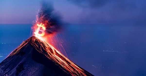
A recent study proposes a novel criterion for determining if an underwater volcano may erupt: sea discoloration data from satellite pictures.
Submarine volcanoes have been erupting often in recent years. Anak Krakatau in Indonesia, White Island in New Zealand, and Nishinoshima Island in Japan have experienced explosions during the last two years alone. In order to provide information that could save lives and guarantee the safety of air and sea transport in the area, it is essential to look out for signals of volcanic activity.
Even though each volcano behaves differently and it can be challenging to forecast when one will erupt, scientists are keeping an eye out for five warning signs: increased seismic activity, growth of magma pools, increases in volcanic gas production, and temperature increases.
Yuji Sakuno, a remote sensing expert and associate professor at the Graduate School of Advanced Science and Engineering at Hiroshima University, developed a new indication sea color for undersea volcanoes.
It has long been understood that the chemical makeup of seawater that has turned discolored and volcanic activity are related. However, there aren’t many quantitative studies that have looked into it using remote sensing. And only the reflectance pattern of saltwater that has discolored has been examined in these few investigations.
In the future, I would like to establish a system that can predict volcanic eruptions with higher accuracy in cooperation with the Japan Aerospace Exploration Agency (JAXA), the Maritime Security Agency, which is monitoring submarine volcanoes, and related research.
Yuji Sakuno
“This is an extremely challenging research result for predicting volcanic disasters that have frequently occurred in various parts of the world in recent years using a new index called sea color,” Sakuno said.
“I was the first in the world to propose the relationship between the sea color information obtained from satellites and the chemical composition around submarine volcanoes.”
The findings of the study are published in the April 2021 issue of the journal Water.
According to Sakuno, depending on the activity of the volcano, chemicals are released that might alter the color of the water nearby. If there is more iron present, the water may turn yellow or brown; if there is more aluminum or silicon present, the water may turn white with spots.
However, sunshine can also alter the hue of the sea, which is an issue. The study examined how brightness concerns were resolved in earlier studies that chromatically evaluated hot spring water to overcome this obstacle.
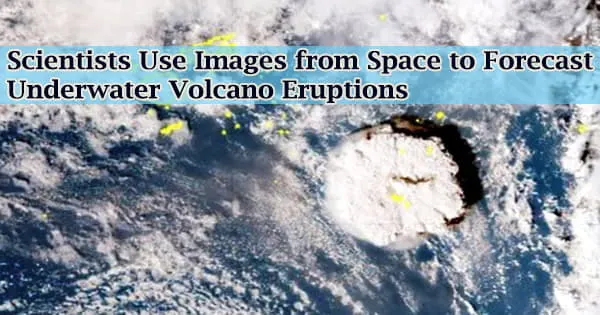
Using the XYZ colorimetric approach, a relationship between seawater color and chemical composition was discovered. Sakuno looked at photos of Nishinoshima Island taken by the Japanese GCOM-C SGLI and Himawari-8 satellites last year.
Both GCOM-C SGLI and Himawari-8 were used to collect data on sea color and volcanic activity, respectively. GCOM-C SGLI is a great option for monitoring due to its short observation cycle, which involves taking photographs of the ocean every two to three days, and excellent spatial resolution of 250 m.
Sakuno examined satellite data from January to December 2020 using the new indicator and was able to detect indications of impending volcanic unrest in Nishinoshima Island about a month before it actually began.
“In the future, I would like to establish a system that can predict volcanic eruptions with higher accuracy in cooperation with the Japan Aerospace Exploration Agency (JAXA), the Maritime Security Agency, which is monitoring submarine volcanoes, and related research,” he said.