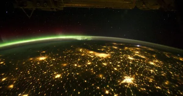
A group of researchers has developed a method for producing daily global moderate-resolution nighttime light change maps. When the sun goes down and the lights go out or don’t, a plethora of data from the night sky can be gathered by satellite, providing insights into the dynamic human activities taking place on the surface.
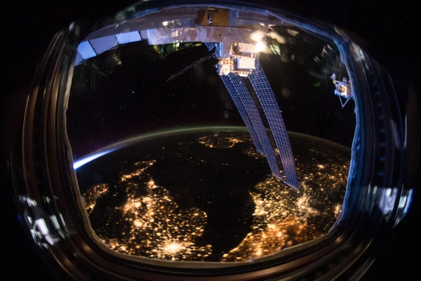
With remote sensing, things like land use changes, urban development, and forest management can be reliably and accurately measured by daylight. At nighttime, we can gather different kinds of data. One way to do this is with NASA’s Black Marble, a product suite that scans the sky each night and is powerful enough to sense all kinds of lights on the surface of Earth, from holiday lights to a single 12,000-lumen flashlight, from space.
However, the data gathered at night can be difficult to analyze says Department of Natural Resources and the Environment Assistant Professor and Director of the Global Environmental Remote Sensing (GERS) Laboratory Zhe Zhu. He explains nighttime satellite data can be influenced by many factors, which leads to a large degree of temporal variation, even for the well-calibrated NASA Black Marble data.
“The first time I looked at a time series of the data, I felt like it was almost impossible to use,” says Zhu.
A team of researchers from GERS including Zhu and NRE Ph.D. student Tian Li, along with researchers from NASA and the University of Maryland Earth System Science Interdisciplinary Center has developed a method that is capable of providing daily global moderate-resolution nighttime light change maps. The results are published in the journal Remote Sensing of Environment.
Though Black Marble already reduces quite a bit of exterior noise, Zhu and Li sought a way to further reduce the fluctuations and make the data even better.
We applied different sets of models to describe the entire nighttime light data time series and the data subsets of different viewing zenith angle intervals. In this way, we mitigated the viewing direction and local geometry variations without the need for three-dimension data. A change will be captured if it is predicted by any of the viewing angle interval models.
Tian Li
Many factors cause temporal variation in the signal that reaches the sensors. Zhu gives the example of moonlight, which impacts how much illumination the sensors receive throughout the moon’s phases and movement across the night sky. Some objects can distort the reflection of moonlight, like buildings, trees, or other structures. Atmospheric conditions can cause further signal deviations, with things like aerosols or haze.
Zhu says they realized daily fluctuations could also be caused by the view direction and the artificial illumination source; for example, if the satellite is looking from directly overhead at a tall building, it may not see the emission of light from windows, or in more rural areas, there may be trees obstructing the view from the sides.
To overcome some of these obstacles, Zhu says three-dimensional digital models could be incorporated to account for building height or if there are trees around to forecast the influence of these illumination differences, but it would be nearly impossible to account for everything, such as the height of every single tree or building. Instead, Li found a different way, by incorporating multiple viewing angles for individual pixels, organizing them into groups, and then basing the observations from somewhere in between.
“Tian spent a few years on this, and she figured out a way to substantially reduce this data variation,” says Zhu. “We created an algorithm called VZA-COLD which stands for Viewing Zenith Angle stratified COntinuous monitoring of Land Disturbance.”
“We applied different sets of models to describe the entire nighttime light data time series and the data subsets of different viewing zenith angle intervals. In this way, we mitigated the viewing direction and local geometry variations without the need for three-dimension data. A change will be captured if it is predicted by any of the viewing angle interval models.” says Li.
With VZA-COLD, the researchers could use Black Marble data to track human activity and behavior changes continuously, on a global scale. Zhu says this greatly reduced the variation in the signal and within each group they were able to detect change with high accuracy and in a timely manner.
The researchers can obtain the change time, the change magnitude, and the change direction. Zhu says this is important because, at a certain view angle, change may not be visible, but is visible at another interval of view angles.
“This makes the information useful, solves the issue of temporal variation, and provides extra angular change information for the artificial lights.”
In the past, researchers would typically analyze a month’s worth of data to create composite data sets. This analysis is limited and cannot provide accurate detection of short-term nighttime light changes. For example, with recent hurricanes, Black Marble can now monitor nighttime light changes as it occurs, quickly pinpointing where power outages are soon after the storm passes.
Other applications range from monitoring wars, such as those in Ukraine and Syria, where near real-time information could aid in humanitarian efforts.
Tracking urbanization processes, migration, power grid variations, gas flares, illegal fishing operations, wildfires, and even the transition to LED lights are other applications that this technology can be used to monitor. The possibilities are vast, as Zhu points out, since human activities are so closely tied to how we use energy, and this will inevitably show up in the satellite-measured nighttime lights.
Zhu says that nighttime light change can provide different insights into people’s activity and behavior, like public gatherings and holidays, than daytime observations. One example he cites is the Olympic stadium in Seoul, South Korea.
“We can view when the building was started to be built and when the roof was complete, then after the Olympics, it is less used,” he says. “This is an example of transitions in construction activity stages and usage activity that we are not able to monitor during the daytime. I think this is going to be game-changing for a lot of things.”
“We are excited to see the patterns of all these different types of human-made light changes at night in the past decade, this provides us unique opportunities to understand the human-environment system over the globe,” says Li.
“We are now working with NASA to create a global product using this algorithm that will be released in 2023. It will be updated annually for every Earth’s land surface location. There are also plans to get the near-real-time capability embedded in the global product,” says Zhu.
