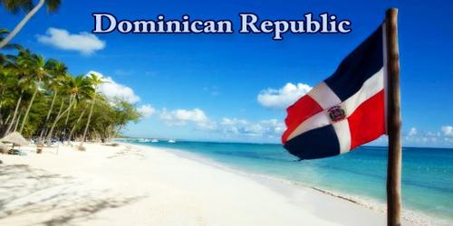
Dominican Republic (/dəˈmɪnɪkən/ də-MIN-ik-ən; Spanish: República Dominicana, pronounced – reˈpuβlika ðominiˈkana), is country of the West Indies that occupies the eastern two-thirds of Hispaniola, the second-largest island of the Greater Antilles chain in the Caribbean Sea. The Dominican Republic is a top choice for budget-minded travelers, but this popular vacation destination is much more than glorious beaches and great-value resorts. Rich in history and culture, “DR,” as it’s called, also boasts some of the most diverse eco-systems in the Caribbean, with steamy jungles, deserts, mangroves, coral reefs, savanna, and soaring green peaks. The “Dominican” word comes from the Latin Dominicus, meaning Sunday. However, the island has this name by Santo Domingo de Guzmán (Saint Dominic), founder of the Order of the Dominicans.
Haiti, also an independent republic, occupies the western third of the island. The Dominican Republic’s shores are washed by the Caribbean to the south and the Atlantic Ocean to the north. Between the eastern tip of the island and Puerto Rico flows the Mona Passage, a channel about 80 miles (130 km) wide. The Turks and Caicos Islands are located some 90 miles (145 km) to the north, and Colombia lies about 300 miles (500 km) to the south. The republic’s area, which includes such adjacent islands as Saona, Beata, and Catalina, is about half the size of Portugal. The national capital is Santo Domingo, on the southern coast.
The Dominican Republic occupies the eastern five-eighths of the island, which it shares with the Republic of Haiti, making Hispaniola one of only two Caribbean islands, along with Saint Martin, that are shared by two sovereign states. The Dominican Republic is the second-largest nation in the Antilles by area (after Cuba) at 48,671 square kilometers (18,792 sq mi), and third by population with approximately 10.5 million people (2020 est.), of whom approximately 3.3 million live in the metropolitan area of Santo Domingo, the capital city.
The Dominican Republic was explored by Columbus on his first voyage in 1492. He named it La Española, and his son, Diego, was its first viceroy. The capital, Santo Domingo, founded in 1496, is the oldest European settlement in the Western Hemisphere. Spain ceded the colony to France in 1795, and Haitian blacks under Toussaint L’Ouverture conquered it in 1801. In 1808, the people revolted and captured Santo Domingo the next year, setting up the first republic. Spain regained title to the colony in 1814. In 1821 Spanish rule was overthrown, but in 1822 the colony was reconquered by the Haitians. In 1844, the Haitians were thrown out and the Dominican Republic was established, headed by Pedro Santana. Uprisings and Haitian attacks led Santana to make the country a province of Spain from 1861 to 1865.
Dominicans have experienced political and civil disorder, ethnic tensions, export-oriented booms and busts, and long periods of military rule, including a Haitian occupation (1822–44), the oppressive dictatorship of Rafael Trujillo (1930–61), and military interventions by the United States (1916–24 and 1965–66). However, the nation’s troubles have paled in comparison with those of neighboring Haiti. The two countries have long been strategic because of their proximity to the United States and their positions on major sea routes leading to the Caribbean and the Panama Canal.
The Dominican Republic has the ninth-largest economy in Latin America and is the largest economy in the Caribbean and Central American region. Over the two decades to 2012, the Dominican Republic has had one of the fastest-growing economies in the Americas with an average real GDP growth rate of 5.4% between 1992 and 2014. GDP growth in 2014 and 2015 reached 7.3 and 7.0%, respectively, the highest in the Western Hemisphere. In the first half of 2016 the Dominican economy grew 7.4% continuing its trend of rapid economic growth. Recent growth has been driven by construction, manufacturing, tourism, and mining. The country is the site of the second largest gold mine in the world, the Pueblo Viejo mine. Private consumption has been strong, as a result of low inflation (under 1% on average in 2015), job creation, and a high level of remittances.
After the devastating earthquake on January 12, 2010 in Haiti, the Dominican Republic was one of the first countries to offer aid despite the two countries having a history of conflict. The Dominican Republic sent food, medicine, and teams to assess the damage. The country also eased visa requirements so the injured could seek treatment at Dominican hospitals.
The Dominican Republic comprises the eastern two-thirds of Hispaniola, the second largest island in the Greater Antilles, with the Atlantic Ocean to the north and the Caribbean Sea to the south. It shares the island roughly at a 2:1 ratio with Haiti, the north-to-south (though somewhat irregular) border between the two countries being 376 km (234 mi). To the north and north-west lie The Bahamas and the Turks and Caicos Islands, and to west, across the Mona Passage, the US Commonwealth of Puerto Rico. The country’s area is reported variously as 48,442 km2 (18,704 sq mi) (by the embassy in the United States) and 48,670 km2 (18,792 sq mi), making it the second largest country in the Antilles, after Cuba. The Dominican Republic’s capital and largest city Santo Domingo is on the southern coast.
Its major mountain ranges and elongated, fertile valleys mainly extend from northwest to southeast. The Cordillera Septentrional, the northernmost range, looms above a narrow coastal plain drained by such short rivers as the Balabonico and the Yasica. The southern slopes of the mountains give way to the extensive Cibao Valley, which stretches from Manzanillo Bay in the northwest to the Samaná Peninsula and the Bay of Samaná in the east. The valley’s fertile soils are fed by two of the nation’s main river systems: the Yaque del Norte, which flows generally northwestward, and the Camu-Yuna system, which flows eastward.
The highest range in the Dominican Republic indeed, in the whole of the West Indies is the Cordillera Central (“Central Mountain Range”). It gradually bends southwards and finishes near the town of Azua, on the Caribbean coast. In the Cordillera Central are the four highest peaks in the Caribbean: Pico Duarte (3,098 metres or 10,164 feet above sea level), La Pelona (3,094 metres or 10,151 feet), La Rucilla (3,049 metres or 10,003 feet), and Pico Yaque (2,760 metres or 9,055 feet). In the southwest corner of the country, south of the Cordillera Central, there are two other ranges: the more northerly of the two is the Sierra de Neiba, while in the south the Sierra de Bahoruco is a continuation of the Massif de la Selle in Haiti. There are other, minor mountain ranges, such as the Cordillera Oriental (“Eastern Mountain Range”), Sierra Martín García, Sierra de Yamasá, and Sierra de Samaná.
Bounding the San Juan Valley to the south is the Sierra de Neiba, which corresponds to the Matheux and Trou d’Eau mountains of Haiti; its high peaks reach approximately 7,200 feet (2,200 metres). Water flowing off the Neiba range drains partly to the Caribbean, via the Yaque del Sur system, and partly inland, to saline Lake Enriquillo. Enriquillo is the country’s largest natural lake, about 23 miles (37 km) long and up to 11 miles (18 km) wide; the lake’s surface is also the lowest point in the West Indies, at 144 feet (44 metres) below sea level. The Dominican Republic’s southernmost range, the Sierra de Baoruco (Bahoruco), is called the Massif de la Selle in Haiti; it overlooks Cape Beata and the arid southwestern plain, including the largely infertile Pedernales region.
The Llano Costero del Caribe (“Caribbean Coastal Plain”) is the largest of the plains in the Dominican Republic. Stretching north and east of Santo Domingo, it contains many sugar plantations in the savannahs that are common there. West of Santo Domingo its width is reduced to 10 kilometres (6.2 mi) as it hugs the coast, finishing at the mouth of the Ocoa River. Another large plain is the Plena de Azua (“Azua Plain”), a very arid region in Azua Province. A few other small coastal plains are on the northern coast and in the Pedernales Peninsula.
Four major rivers drain the numerous mountains of the Dominican Republic. The Yaque del Norte is the longest and most important Dominican river. It carries excess water down from the Cibao Valley and empties into Monte Cristi Bay, in the northwest. Likewise, the Yuna River serves the Vega Real and empties into Samaná Bay, in the northeast. Drainage of the San Juan Valley is provided by the San Juan River, tributary of the Yaque del Sur, which empties into the Caribbean, in the south. The Artibonito is the longest river of Hispaniola and flows westward into Haiti. There are many lakes and coastal lagoons. The largest lake is Enriquillo, a salt lake at 45 metres (148 ft) below sea level, the lowest elevation in the Caribbean. Other important lakes are Laguna de Rincón or Cabral, with fresh water, and Laguna de Oviedo, a lagoon with brackish water.
The country’s most fertile alluvial soils are located in the valleys of the Yaque del Norte, Yuna, San Juan, and Yaque del Sur rivers, as well as the Ozama and various smaller rivers in the southeast. The mountain slopes have lower-quality soils and are generally covered in forests and grasslands. Salt deposited around Lake Enriquillo creates some of the nation’s only unproductive soils.
The Dominican Republic has a moderate, relatively mild tropical climate, although it lies well within the tropical zone. Conditions are ameliorated in many areas by elevation and by the northeast trade winds, which blow steadily from the Atlantic all year long. The annual mean temperature is 77 °F (25 °C); regional mean temperatures range from 69 °F (21 °C) in the heart of the Cordillera Central to as high as 82 °F (28 °C) on the coastal plains. Temperatures rarely rise above 90 °F (32 °C), and freezing temperatures are unknown.
The Dominican Republic is located near fault action in the Caribbean. In 1946, it suffered a magnitude 8.1 earthquakes off the northeast coast, triggering a tsunami that killed about 1,800, mostly in coastal communities. Caribbean countries and the United States have collaborated to create tsunami warning systems and are mapping high-risk low-lying areas. The heaviest precipitation is in the mountainous northeast (the windward side of the island), where the average annual rainfall is more than 100 inches (2,540 mm). As the trade winds pass over the country, they lose their moisture on various mountain slopes, so that the far western and southwestern valleys, along the Haitian border, remain relatively dry, with less than 30 inches (760 mm) of annual precipitation. The northwestern and southeastern extremes of the country are also arid. Tropical cyclones strike the Dominican Republic every couple of years, with 65% of the impacts along the southern coast. Hurricanes are most likely between June and October. The last major hurricane that struck the country was Hurricane Georges in 1998.
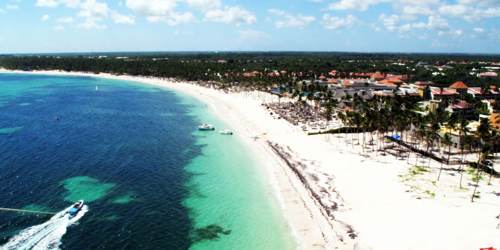
Vegetation varies considerably, but there is generally more ground cover in the Dominican Republic than in neighbouring Haiti. The mountains are still largely forested with pines and tropical hardwoods; although the trees on the lower and more accessible slopes have been severely cut for use as charcoal and commercial lumber. In the drier regions low shrubs and scrub predominate, but grasslands and dense rainforests occur where there is heavier precipitation. Royal palms grow throughout much of the country. Cultivated crops have largely replaced the natural vegetation in many areas, particularly in the more fertile upland valleys and on the lower mountain slopes. Mangrove swamps line some coastal areas, whereas extensive sandy beaches are found elsewhere, notably along the northern shore.
Wild animals are not abundant; for several centuries cattle and goats, introduced by the early Spanish colonists, ran wild on the grasslands and in the desert areas. Alligators are found near the mouths of the Yaque rivers and in the waters of Lake Enriquillo. A great variety of birds, including ducks, are hunted. Fish and shellfish inhabit the surrounding waters, particularly within the coral reefs.
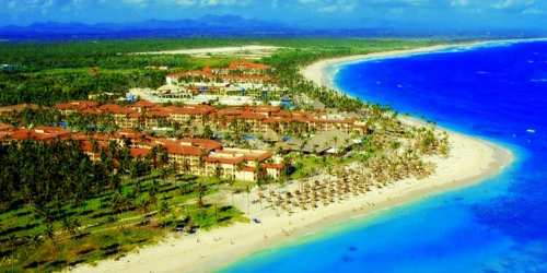
Venture away from the tourist strips of Puerto Plata, Punta Cana, La Romana, and Samaná, where all-inclusive resorts cluster along idyllic sweeps of palm-fringed beach, and visitors will discover a world of adventures. Visitors can climb the highest peaks in the Caribbean, raft the white waters of the Río Yaque del Norte, hike to waterfalls through the steamy jungle, and bike through pine forests along alpine trails. Cultural attractions are also a highlight.
Ecotourism has also been a topic increasingly important in this nation, with towns like Jarabacoa and neighboring Constanza, and locations like the Pico Duarte, Bahia de las Aguilas, and others becoming more significant in efforts to increase direct benefits from tourism. Most residents from other countries are required to get a tourist card, depending on the country they live in. In the last 10 years, the Dominican Republic has become one of the worlds notably progressive states in terms of recycling and waste disposal. A UN report cited there was a 221.3% efficiency increase in the previous 10 years due, in part, to the opening of the largest open-air landfill site located in the north 10 km from the Haitian border.
The capital, ‘Santo Domingo’, is a UNESCO World Heritage Site, with charming colonial architecture and fascinating history. The Cibao Valley is also densely settled, particularly in its central and eastern sections at Santiago, San Francisco de Macorís, and La Vega. Santiago, the nation’s second-largest city, vies with Santo Domingo in political, cultural, and economic matters. Secondary coastal centres include La Romana and San Pedro de Macorís in the southeast, Barahona in the southwest, and Puerto Plata in the north. South of the Cordillera Central lies an alluvial plain where rice is grown; its population is centered on San Juan de la Maguana.
Information Sources: