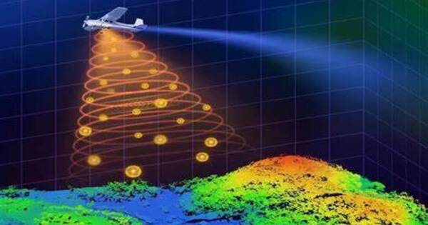
Researchers created a tiny and lightweight single-photon airborne lidar device that can capture high-resolution 3D images using a low-power laser. This advancement may make single-photon lidar useful for air and space applications such as environmental monitoring, 3D terrain mapping, and object recognition.
Single-photon lidar measures the time it takes for laser pulses to travel to and from objects. It is especially valuable for airborne applications since it allows for highly accurate 3D mapping of terrain and objects, even in tough conditions like dense foliage or metropolitan areas.
“Using single-photon lidar technology on resource-limited drones or satellites requires shrinking the entire system and reducing its energy consumption,” said research team member Feihu Xu from University of Science and Technology of China. “We were able to incorporate recent technology developments into a system that, in comparison to other state-of-the-art airborne lidar systems, employs the lowest laser power and the smallest optical aperture while still maintaining good performance in terms of detection range and imaging resolution.”
We were able to incorporate recent technology developments into a system that, in comparison to other state-of-the-art airborne lidar systems, employs the lowest laser power and the smallest optical aperture while still maintaining good performance in terms of detection range and imaging resolution.
Feihu Xu
In Optica, Optica Publishing Group’s journal for high-impact research, the researchers show that the system has the capability to achieve an imaging resolution that surpasses the diffraction limit of light when used with sub-pixel scanning and a new 3D deconvolution algorithm. They also demonstrate the system’s ability to capture high-resolution 3D images during daytime over large areas aboard a small plane.
“Ultimately, our work has the potential to enhance our understanding of the world around us and contribute to a more sustainable and informed future for all,” said Xu. “For example, our system could be deployed on drones or small satellites to monitor changes in forest landscapes, such as deforestation or other impacts on forest health. It could also be used after earthquakes to generate 3D terrain maps that could help assess the extent of damage and guide rescue teams, potentially saving lives.”
Shrinking single-photon lidar
The innovative airborne single-photon lidar device transmits light pulses from a laser to the ground. These pulses bounce off objects and are detected using highly sensitive detectors known as single-photon avalanche diode (SPAD) arrays. These detectors have a higher sensitivity to single photons, allowing for more effective detection of reflected laser pulses and the use of a lower-power laser. To reduce the overall system size, the researchers used small telescopes with an optical aperture of 47 mm for the reception optics.
Measuring the time-of-flight of the returned single photons makes it possible to calculate the time it takes for the light to travel to the ground and back. The detailed 3D images of the terrain can then be reconstructed from this information using computational imaging algorithms.
“A key part of the new system is the special scanning mirrors that perform continuous fine scanning, capturing sub-pixel information of the ground targets,” said Xu. “Also, a new photon-efficient computational algorithm extracts this sub-pixel information from a small number of raw photon detections, enabling the reconstruction of super-resolution 3D images despite the challenges posed by weak signals and strong solar noise.”
Ground and air testing
The researchers ran a number of tests to validate the new system’s capabilities. A pre-flight ground test confirmed the technique’s efficiency, demonstrating that the device could do lidar imaging with a 15 cm resolution from 1.5 km distant using the default settings. After implementing sub-pixel scanning and 3D deconvolution, the researchers were able to achieve an effective resolution of 6 cm from the same distance.