According to a recent study, determining how long it takes for a radar pulse to travel from a satellite to the ocean’s surface and back can help determine the thickness of river ice and the best times of year to cross ice bridges and roads in the Arctic.
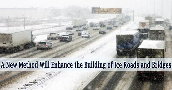
In order to transport commodities and ensure food security, many northern towns in Canada rely on a network of ice highways constructed on frozen lakes and rivers. The viability of these routes is jeopardized by climate change, which shortens the ice season and makes the ice thinner.
Radar altimetry is a method that was utilized by researchers from the University of Waterloo to better understand how frozen rivers improve connections and supply to diverse ice-covered communities.
The functioning of the aquatic system, the operation of hydropower plants, construction, and navigation are all impacted by river ice, which is a significant part of the planet’s environment.
“Many remote villages that are linked in summer to supply centres only via expensive aircraft or boat transport can directly access the primary land transport arteries built on frozen ground and lake or river ice,” said Claude Duguay, professor of Geography and Environmental Management at Waterloo.
“The value of the ice roads is the highest for the icy regions where the construction of permanent bridges is restrained by the presence of permafrost and its destabilization.”
In order to create and test methods for obtaining river ice phenology dates and ice thickness over a region including the lower reaches of the Ob River in Siberia, Russia, the researchers used data from two altimetric satellite missions, Jason-2 and Jason-3.
Many remote villages that are linked in summer to supply centres only via expensive aircraft or boat transport can directly access the primary land transport arteries built on frozen ground and lake or river ice. The value of the ice roads is the highest for the icy regions where the construction of permanent bridges is restrained by the presence of permafrost and its destabilization.
Claude Duguay
The researchers discovered that the manual process of their algorithm effectively detected the beginning of ice thermal degradation by comparing the dates of the altimetry-derived melt start with those of the ice condition flags provided by gauging stations.
The study demonstrates that a number of variables might impact the accuracy of the river ice thickness retrievals in arctic regions and consequently the radar return echoes.
“One of the main advantages of satellite altimetry compared with imaging synthetic aperture radar is the relative ease in processing the measurements over the large hemispheric-scale domain,” Duguay said.
Since the technique they devised for the ice phenology dates is independent of the availability of on-site data, it can be used with different rivers, lakes, and bogs.
The study demonstrated that for various river segments, particularly for the long river stretches, the obtained empirical relations between the on-site data and satellite backscatter measurements are similar.
The study was recently published in The Cryosphere, an international scientific journal of European Geoscience Union.