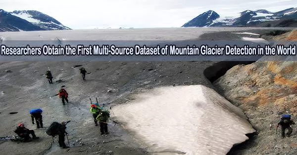
According to the Aerospace Information Research Institute (AIR), Chinese Academy of Sciences (CAS), Chinese scientists have successfully acquired mountain glacier data using an aeronautic remote sensing system during an ongoing airborne-ground science experiment on determining the condition of Bayi Glacier in Haibei Tibetan Autonomous Prefecture, northwest China’s Qinghai Province.
A combination P-band, L-band, and VHF-band radar glacier detection experiment was run from an airborne platform for the first time ever.
The Institute of Tibetan Plateau Research, the Aerospace Information Research Institute, the Northwest Institute of Eco-Environment and Resources, and the Innovation Academy jointly conducted the experiment for Precision Measurement Science and Technology, all of which are affiliated with CAS, and Wuhan University.
It started on March 20 and is scheduled to end in mid-May. The airborne remote sensing system has carried out a total of 11 flights so far, including 7 flights for P/L-band tomographic and interferometric imaging and 4 flights for VHF-band fluoroscopic imaging, collecting 4.6 TB of useful data.
The VHF band airborne radar onboard is China’s first domestic aerial glacier detection payload independently developed by AIR. It is also the first time a domestic remote sensing aircraft has flown above 4,500 meters in the mountain region.
Professor Wu Yirong
The researchers performed ground-penetrating radar glacier thickness measurements, ultra-long-range 3D laser point cloud imaging, simultaneous optical and LiDAR observations of the ice surface, onboard instrument calibration of the ice surface, and ground-penetrating radar glacier thickness measurements.
An initial analysis of the data revealed that the 3D reconstruction findings of the P-band and L-band synthetic aperture radar (SAR) pictures could depict the varying trend of glacier surface elevation, which is essentially consistent with the results of the aerial 3D LiDAR and ground survey.
The ice core borehole’s purposely placed electrical anomalies, which were located at a depth of 80 meters, could be clearly seen in the VHF data’s distinct glacier profile, which also showed the interface line between the atmosphere, ice surface, and bedrock. The ground-sounding results and the depth of the profile interpretation were essentially in agreement.
The preliminary findings demonstrated that the experiment had proven the viability of the joint P/L/VHF bands experiment, collected reliable data, and validated the comprehensive observation technique of glacier characteristics.
The National Tibetan Plateau Science Data Center will continue to release and share the experiment’s data in order to encourage the development of remote sensing inversion techniques for determining the thickness and internal structure of glaciers.
Prof. Wu Yirong, director-general of AIR, noted that “the VHF band airborne radar onboard is China’s first domestic aerial glacier detection payload independently developed by AIR. It is also the first time a domestic remote sensing aircraft has flown above 4,500 meters in the mountain region.”
This experiment marked the advancement of the next-generation cryosphere remote sensing technology by demonstrating the capacity to monitor glacier thickness and calculate ice reserve using aircraft remote sensing.
In July 2021, the AIR-hosted aeronautical remote sensing system began its formal operations. It has taken on numerous scientific research tasks, such as large-scale aviation remote sensing comprehensive scientific experiments, new remote sensing payload calibration, and disaster and environmental monitoring, and obtained a significant amount of valuable scientific data.
It also has the most comprehensive aerial remote sensing platform and scientific experiment platform in China.