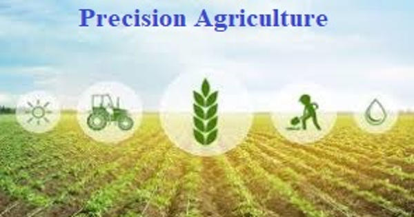
Precision Agriculture
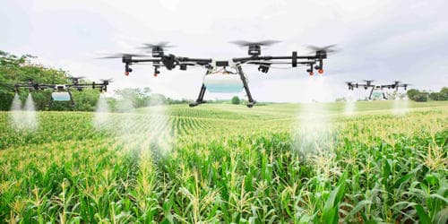
Drones allow farmers to constantly monitor crop and livestock conditions by air to quickly find problems that would not become apparent in ground-level spot checks. Precision agriculture (PA), satellite farming, or site-specific crop management (SSCM) is a farming management concept based on observing, measuring, and responding to inter and intra-field variability in crops. It refers to the way farmers manage crops to ensure the efficiency of inputs such as water and fertilizer and to maximize productivity, quality, and yield. The goal of precision agriculture research is to define a decision support system (DSS) for whole-farm management with the goal of optimizing returns on inputs while preserving resources. The term also involves minimizing pests, unwanted flooding, and disease. A key component of this farm management approach is the use of information technology and a wide array of items such as GPS guidance, control systems, sensors, robotics, drones, autonomous vehicles, GPS-based soil sampling, and software.
“Precision Agriculture refers to the way farmers manage crops to ensure the efficiency of inputs such as water and fertilizer and to maximize productivity, quality, and yield.”
The increasing adoption rate of technology in agriculture shouldn’t be surprising to anyone. Among these many approaches is a phytogeomorphological approach that ties multi-year crop growth stability/characteristics to topological terrain attributes. The interest in the phytogeomorphological approach stems from the fact that the geomorphology component typically dictates the hydrology of the farm field. For example, a farmer might find through time-lapse drone photography that part of his or her crop is not being properly irrigated. This reduces steering errors by drivers and therefore any overlap passes on the field. In turn, this results in less wasted seed, fertilizer, fuel, and time.
Agriculture, in general, has undergone a similar evolution. Technology has become an indispensable part of doing business for every farmer, ag retailer, and agronomist. The practice of precision agriculture has been enabled by the advent of GPS and GNSS. Farming is highly land and labor-intensive. Farmers are driven to use technology to increase efficiency and manage costs. The farmer’s and/or researcher’s ability to locate their precise position in a field allows for the creation of maps of the spatial variability of as many variables as can be measured (e.g. crop yield, terrain features/topography, organic matter content, moisture levels, nitrogen levels, pH, EC, Mg, K, and others). This is a farming management system based on the use of modern technologies at every stage of work. Similar data is collected by sensor arrays mounted on GPS-equipped combine harvesters. These arrays consist of real-time sensors that measure everything from chlorophyll levels to plant water status, along with multispectral imagery.
This data is used in conjunction with satellite imagery by variable rate technology (VRT) including seeders, sprayers, etc. to optimally distribute resources. Precision agriculture was born with the introduction of GPS guidance for tractors in the early 1990s, and the adoption of this technology is now so widespread globally that it’s probably the most commonly-used example of precision ag today. However, recent technological advances have enabled the use of real-time sensors directly in the soil, which can wirelessly transmit data without the need for human presence.