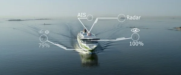
Shipping automation is increasing. Advances in Artificial Intelligence (AI) applications such as collision avoidance and computer vision have the potential to augment or replace the roles of ship navigators. However, if AI technologies are implemented in a way that reduces human control, they may jeopardize safety.
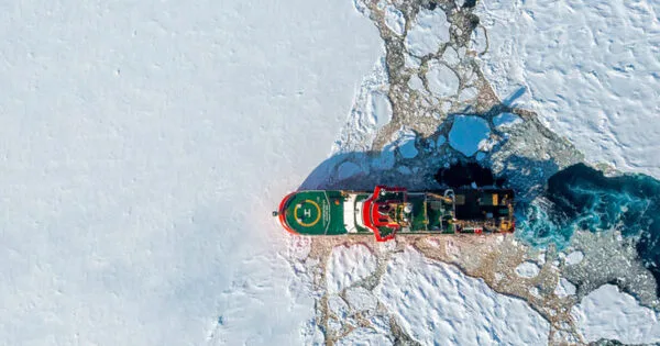
Ships navigating in polar ocean conditions will be more efficient thanks to artificial intelligence (AI) and a new route planning tool developed by British Antarctic Survey (BAS) researchers. The tool’s goal is to reduce carbon emissions while also improving science.
The BAS AI Lab’s system will be used by the crew of the RRS Sir David Attenborough, the United Kingdom’s polar research ship, to make route planning decisions. It will recommend the shortest and most fuel-efficient routes between two points while taking into account all polar conditions such as sea ice, ocean dynamics, and weather. With their vast knowledge and experience of sailing around the icy continent, the Captain and officers can evaluate the options and choose the best route.
We’ve created something that is very similar to the kind of in-car navigation system like Google maps that many of us already use, but with the added complication that there are no roads in the ocean, and the conditions are changing constantly, which affects the routes between destinations.
Professor Maria Fox
The project team created algorithms that use a wide range of existing environmental datasets and forecasts to create a navigational route planner that updates as conditions change, similar to an in-car navigation system. The tool will be able to forecast environmental conditions for an entire research season of up to six months in advance, allowing for long-term seasonal route planning.
“We’ve created something that is very similar to the kind of in-car navigation system like Google maps that many of us already use, but with the added complication that there are no roads in the ocean, and the conditions are changing constantly, which affects the routes between destinations,” says Professor Maria Fox of the BAS AI Lab, who leads the project.
“The key driver here is to create something that reduces the ship’s carbon emissions and makes our science more efficient. We’re really excited about this open-source project which we think will be of value to all ships operating in the polar oceans.”
The first stage of the project is to develop a tool which can optimize route planning for carbon efficiency. This route planner is therefore a key piece in the puzzle in helping BAS achieve its aim of being net zero by 2040. Integration with on-board systems on the SDA began in November this year.
As the tool develops, the team will integrate more live data from the ship, such as speed and fuel requirements in different conditions, to refine the model and improve route efficiency even more. The team also intends eventually to integrate science and logistics tasks into the planning tool.
Captain Will Whatley, Master of RRS Sir David Attenborough, says, “This innovative new tool is going to help us ensure RRS Sir David Attenborough remains as fuel efficient as possible. I’m particularly excited to see how it performs around ice. There are many systems out there that can give weather routing in open ocean but this tool is unique by adding the capability to consider ice, allowing us to reduce our fuel usage and environmental impact during the field season.”