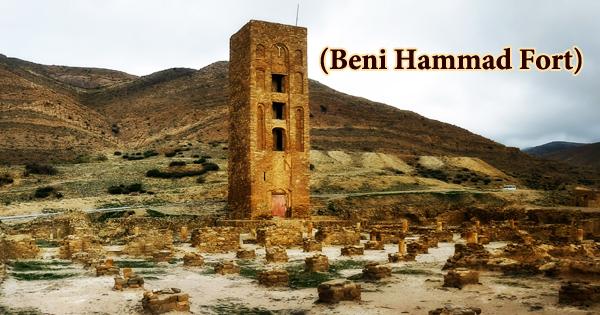
Beni Hammad Fort is located in the Jebel Maadid, a mountainous area about 100 km south of the Mediterranean coast near the town of M’Sila, Algeria. A fortified Palatine town in Algeria is also known as Al Qal’a of Beni Hammad (Arabic: قلعة بني حماد). Now in ruins, it served as the first capital of the Hammadid dynasty in the 11th century. Qalat Beni Hammad is a ruined imperial Islamic city founded in central Algeria during the 11th century CE (fourth century AH). After their freedom from the Zirids and the Fatimids of Tunisia, the seat of the Hammadids was founded by the founder of the Hammadid dynasty, Hammad bin Buluggin I (reg. 1015-1028 CE / AH 406-419), starting in 1007 CE (AH 397). The fort is northeast of M’Sila, at an elevation of 1,418 meters (4,652 ft), in the Hodna Mountains and receives ample water from the surrounding mountains. It is one of the Islamic civilization’s most interesting and most correctly dated monumental complexes. It was the first capital of the Emirs of Hammad and had great splendor. Within 7 km of partly dismantled defensive walls, the Qal’a contains a significant number of monumental ruins, including the Great Mosque and its minaret, and a number of palaces. In 1980, it was inscribed as a World Heritage Site by UNESCO, and described as “an authentic picture of a fortified Muslim city”. Hammad ibn Buluggin, the first ruler of Hammad and son of Buluggin ibn Ziri Menad Abu Ziri, founder of Algiers, founded the fort in early 1007. Under a threat from the Arab tribal confederation of Banu Hilal, and was abandoned in 1090 and was partially destroyed by the Almohad Dynasty rulers in 1152.
The mosque is the largest after that of Mansourah and its minaret is the oldest in Algeria after that of Sidi Boumerouane, with its prayer hall containing 13 ships out of 8 bays. The Qal’a Ruins bear witness to the great sophistication of North Africa’s Hammad civilization, original architecture, and palatial culture. The fort is situated approximately 110 kilometers south of the Mediterranean coast and 190 kilometers south-east of Algiers in central northern Algeria. The site is adjacent to Sidi Mohammed el Fadhel’s small village, but the nearest town is M’sila, the modern provincial capital, 26 kilometers southwest of the complex, or 70 kilometers by road. Numerous terracotta, gems, coins, and ceramics that attest to the high degree of civilization under the Hammadid dynasty have been brought to light by excavations. Also, several decorative fountains using the lion as a symbol are among the objects found. Three independent residences divided by gardens and pavilions form the ruins of the emir’s palace, known as Dal al-Bahr. At the center of the north wall, a minaret is located, while public entrances open into the mosque courtyard on the east and west walls. The broad sahn, bordered by arcaded galleries, leads to the hypostyle prayer hall, separated by columns into a grid of 13 aisles wide and 8 bays deep. The mosque featured a wide maqsura, now demolished, occupying an area five bays across and four bays deep on the south wall in front of the qibla niche. It has inspired the development of Arab architecture, including the Maghreb, Andalusia, and Sicily, as well as other civilizing influences. The key artifacts that attest to the richness and influence of this Hammadid culture are the archaeological and monumental vestiges of the Qal’a of Beni Hammad, including the Great Mosque and its minaret, as well as a number of palaces. If it were not largely destroyed today, the Qalat Beni Hammad mosque would be one of the largest in all of Algeria. In the modern period, the site was identified by the French historian Méquesse in 1886. In 1908 CE, under the supervision of the French archaeologist de Beylié, modern excavations of the site were first carried out. Later excavations were undertaken by Lucien Golvin between 1951 and 1952 CE, and after 1964 CE under Bourouiba. The 150-hectare Qalat Beni Hammad site was named in 1980 as a UNESCO World Heritage Centre.


